|
search place name
|
||
Saghandzile (Kharagaulis Raioni, Georgia)Saghandzile is a town in the Kharagaulis Raioni region of Georgia. An overview map of the region around Saghandzile is displayed below.
regional and 3d topo map of Saghandzile, Georgia ::

Nearby towns ::
Zarani (1.9km north) //
Chkheri (2.9km north) //
Patara-Kharagauli (3.1km north) //
Vani (2.5km west) //
Leghvani (3.0km south east) //
Kharagauli (3.5km north) //
Skhliti (3.6km south west) //
P'arts'khnali (3.3km west) //
Bazaletʼi (5.3km north) //
Kroli (5.3km north west) //
Marelisi (5.5km south east) //
Dzhaparauli (6.6km north) //
Tsipi (6.6km north) //
Tʼetʼratsqaro (5.8km north west) //
Gverki (7.0km north) //
Uchameti (7.6km north west) //
Khemagali (7.6km north west) //
Akhalsopeli (6.9km north west) //
Serbaisi (7.4km south east) //
Lashe (9.0km north) //
Lashis-Igoreti (8.4km north west) //
Sabe (9.0km north east) //
Kitskhis-Igoreti (9.3km north west) //
[all distances 'as the bird flies' and approximate] 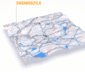 Places with similar names to Saghandzile, Georgia ::
// Savane Désolée (HT)
Disclaimer :: Information on this page comes without warranty of any kind |
||
|
Where is Saghandzile? Elevation and coordinates ::
Latitude (lat): 41°59'26"N Longitude (lon): 43°13'44"E
Elevation (approx.): 487m (map arrows pan, magnifying glasses zoom) |
||
|
Visiting Saghandzile? Hotel/Accommodation ::
Book a hotel in Saghandzile Travel Guide ::
Buy a travel guide for Georgia rental cars ::
car rental offers GPS waypoint ::
download a GPX waypoint (PoI) of Saghandzile for your GPS receiver
|
||