|
search place name
|
||
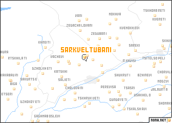
Sarkʼveltʼubani (Chiatʼura, Georgia)Sarkʼveltʼubani is a town in the Chiatʼura region of Georgia. An overview map of the region around Sarkʼveltʼubani is displayed below.
regional and 3d topo map of Sarkʼveltʼubani, Georgia ::
Sarkʼveltʼubani airports ::
The nearest airport is MRV - Mineralnye Vody Mineralnyye Vody, located 212.2 km north of Sarkʼveltʼubani.
Nearby towns ::
Tabagrebi (1.3km north) //
Khalipauri (1.2km east) //
Zeda-Rgani (1.3km south west) //
Mgvimevi (2.6km east) //
Bunikauri (2.7km west) //
Rgani (2.9km west) //
Tsirkʼvali (4.0km north east) //
Chiatʼura (3.6km south east) //
Tsinsopʼeli (4.5km south east) //
Kʼveda Chalovani (4.9km north) //
Zedubani (5.4km north east) //
Vachevi (4.5km west) //
Katsʼkhi (5.1km south west) //
Darkveti (5.2km north east) //
Salietʼi (6.1km south west) //
Zeda-Chalovani (6.9km north) //
Chalovani (7.1km south) //
Kvakhadzheleti (6.5km north east) //
Zodi (6.4km north east) //
Perevisa (7.6km south east) //
Mokhorotubani (7.1km north east) //
Skindori (8.5km south) //
Vani (9.0km north) //
Shukʼrutʼi (7.2km south east) //
Khreitʼi (7.2km north west) //
Sarkveletubani (8.0km south west) //
Mordzgvetʼi (9.0km south west) //
Kalauri (8.4km south east) //
Khvashitʼi (9.0km north east) //
[all distances 'as the bird flies' and approximate] 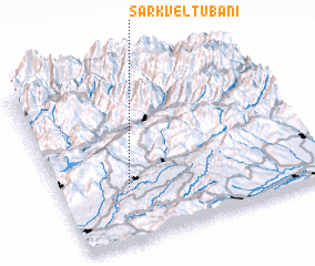 Places with similar names to Sarkʼveltʼubani, Georgia ::
// Sarkveletubani (GE)
Disclaimer :: Information on this page comes without warranty of any kind |
||
|
Where is Sarkʼveltʼubani? Elevation and coordinates ::
Latitude (lat): 42°19'11"N Longitude (lon): 43°15'58"E
Elevation (approx.): 657m (map arrows pan, magnifying glasses zoom) |
||
|
Visiting Sarkʼveltʼubani? Hotel/Accommodation ::
Book a hotel in Sarkʼveltʼubani Travel Guide ::
Buy a travel guide for Georgia rental cars ::
car rental offers GPS waypoint ::
download a GPX waypoint (PoI) of Sarkʼveltʼubani for your GPS receiver
|
||