|
search place name
|
||
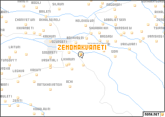
Zemo Makvanetʼi (Abashis Raioni, Georgia)Zemo Makvanetʼi is a town in the Abashis Raioni region of Georgia. An overview map of the region around Zemo Makvanetʼi is displayed below.
regional and 3d topo map of Zemo Makvanetʼi, Georgia ::
Zemo Makvanetʼi airports ::
The nearest airport is ERZ - Erzurum, located 227.9 km south of Zemo Makvanetʼi.
Nearby towns ::
Gogiyeti (1.5km south) //
Chala (2.6km north east) //
Gonebiskari (2.6km north east) //
Likhauri (2.6km south west) //
Kʼvemo Makvanetʼi (2.7km north west) //
Niabauri (3.0km south west) //
Bokhvauri (3.8km north) //
Kvachalati (3.1km south west) //
Kviriketi (3.4km north west) //
Zeda-Uchkhubi (3.6km north east) //
Dvabzu (4.7km north) //
Shemokʼmedi (4.0km north east) //
Tsʼkhemliskhidi (5.0km north east) //
Ozurgetʼi (4.7km north west) //
Ekadiya (4.6km north west) //
Gaghma Dvabze (6.0km north) //
Bagdadi (5.8km north east) //
Shua-Bakhvi (6.5km north east) //
Achi (6.8km south) //
Anaseuli (5.4km west) //
Gogoreti (5.4km west) //
Vashtiali (5.6km west) //
Gomi (5.6km east) //
Melekʼeduri (7.5km north) //
Chaniet'i (5.8km west) //
Kakhuri (6.7km north west) //
Pampaleti (6.9km north east) //
Kʼveda Bakhvi (8.6km north east) //
Natskhavatevi (8.9km south west) //
[all distances 'as the bird flies' and approximate] 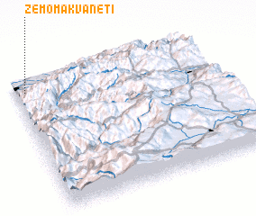 Places with similar names to Zemo Makvanetʼi, Georgia :: Disclaimer :: Information on this page comes without warranty of any kind |
||
|
Where is Zemo Makvanetʼi? Elevation and coordinates ::
Latitude (lat): 41°53'50"N Longitude (lon): 42°2'56"E
Elevation (approx.): 145m (map arrows pan, magnifying glasses zoom) |
||
|
Visiting Zemo Makvanetʼi? Hotel/Accommodation ::
Book a hotel in Zemo Makvanetʼi Travel Guide ::
Buy a travel guide for Georgia rental cars ::
car rental offers GPS waypoint ::
download a GPX waypoint (PoI) of Zemo Makvanetʼi for your GPS receiver
|
||