|
search place name
|
||
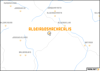
Aldeia dos Machacalis (Minas Gerais, Brazil)Aldeia dos Machacalis is a town in the Minas Gerais region of Brazil. An overview map of the region around Aldeia dos Machacalis is displayed below.
regional and 3d topo map of Aldeia dos Machacalis, Brazil ::
Aldeia dos Machacalis airports ::
The nearest airport is CRQ - Caravelas, located 169.7 km south east of Aldeia dos Machacalis.
Nearby towns ::
Aldeia Velha (6.5km north east) //
Aldeia do Prata (7.6km north) //
[all distances 'as the bird flies' and approximate] 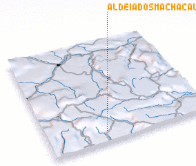 Places with similar names to Aldeia dos Machacalis, Brazil :: Disclaimer :: Information on this page comes without warranty of any kind |
||
|
Where is Aldeia dos Machacalis? Elevation and coordinates ::
Latitude (lat): 16°53'0"S Longitude (lon): 40°38'0"W
Elevation (approx.): 380m (map arrows pan, magnifying glasses zoom) |
||
|
Visiting Aldeia dos Machacalis? Hotel/Accommodation ::
Book a hotel in Aldeia dos Machacalis Travel Guide ::
Buy a travel guide for Brazil rental cars ::
car rental offers GPS waypoint ::
download a GPX waypoint (PoI) of Aldeia dos Machacalis for your GPS receiver
|
||