|
search place name
|
||
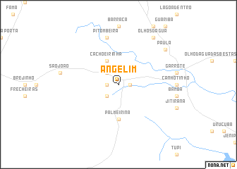
Angelim (Pernambuco, Brazil)Angelim is a town in the Pernambuco region of Brazil. An overview map of the region around Angelim is displayed below.
regional and 3d topo map of Angelim, Brazil ::
Angelim airports ::
The nearest airport is MCZ - Maceio Zumbi Dos Palmares, located 88.0 km south east of Angelim.
Other airports nearby include REC - Recife Guararapes Gilberto Freyre Intl (171.6 km north east), CPV - Campina Grande Presidente Joao Suassuna (183.5 km north), PAV - Paulo Alfonso Paulo Afonso (223.7 km west), JPA - Joao Pessoa Presidente Castro Pinto (241.7 km north east), Nearby towns ::
Cerquinilha (1.8km east) //
Bela Vista (1.8km west) //
Salobro (2.6km north west) //
Saquinho (2.6km south west) //
Cachoeirinha (4.1km north west) //
Palmeirina (5.6km south) //
Pitombeira (7.6km north) //
Olhos dʼÁgua (9.2km north east) //
Paula (9.2km north east) //
[all distances 'as the bird flies' and approximate] 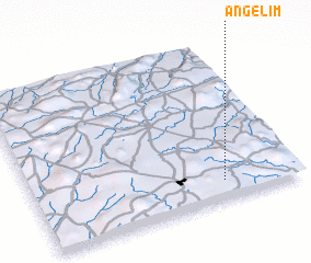 Places with similar names to Angelim, Brazil ::
Disclaimer :: Information on this page comes without warranty of any kind |
||
|
Where is Angelim? Elevation and coordinates ::
Latitude (lat): 8°53'0"S Longitude (lon): 36°17'0"W
Elevation (approx.): 643m (map arrows pan, magnifying glasses zoom) |
||
|
Visiting Angelim? Hotel/Accommodation ::
Book a hotel in Angelim Travel Guide ::
Buy a travel guide for Brazil rental cars ::
car rental offers GPS waypoint ::
download a GPX waypoint (PoI) of Angelim for your GPS receiver
|
||