|
search place name
|
||
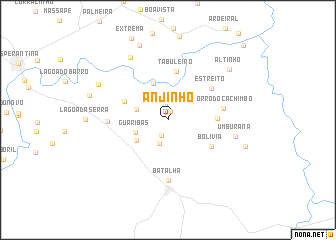
Anjinho (Piauí, Brazil)Anjinho is a town in the Piauí region of Brazil. An overview map of the region around Anjinho is displayed below.
regional and 3d topo map of Anjinho, Brazil ::
Anjinho airports ::
The nearest airport is THE - Teresina Senador Petronio Portella, located 147.1 km south west of Anjinho.
Nearby towns ::
Curral Velho (1.0km north) //
Prazeres (1.8km north) //
Brejo (1.9km south west) //
Altos (2.8km south) //
Pau-DʼArco (3.7km west) //
Guaribas (3.9km west) //
Aposento (4.2km south west) //
Cachoeira do Sapateiro (4.3km north) //
Sapucaia (5.3km north west) //
Olho dʼÁgua das Pedras (5.5km east) //
Tabuleiro (5.5km north) //
Bolívia (5.7km south east) //
Estreito (6.0km north east) //
Morro do Cachimbo (6.3km east) //
Batalha (6.7km south) //
Saco (6.7km west) //
Umburana (7.8km east) //
João Paz (8.1km north west) //
Baixa Fria (8.7km north west) //
Altinho (8.9km north east) //
Lagoa (9.0km north) //
Jatobazal (9.1km east) //
Caraíbas (9.2km west) //
Ius (11.8km north east) //
[all distances 'as the bird flies' and approximate] 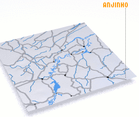
Disclaimer :: Information on this page comes without warranty of any kind |
||
|
Where is Anjinho? Elevation and coordinates ::
Latitude (lat): 3°57'23"S Longitude (lon): 42°5'1"W
Elevation (approx.): 60m (map arrows pan, magnifying glasses zoom) |
||
|
Visiting Anjinho? Hotel/Accommodation ::
Book a hotel in Anjinho Travel Guide ::
Buy a travel guide for Brazil rental cars ::
car rental offers GPS waypoint ::
download a GPX waypoint (PoI) of Anjinho for your GPS receiver
|
||