|
search place name
|
||
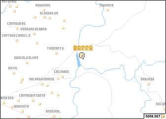
Barra (Ceará, Brazil)Barra is a town in the Ceará region of Brazil. An overview map of the region around Barra is displayed below.
regional and 3d topo map of Barra, Brazil ::
Barra airports ::
The nearest airport is THE - Teresina Senador Petronio Portella, located 173.3 km south west of Barra.
Nearby towns ::
Cacimbas (6.0km south west) //
Timorante (6.2km west) //
Bem-Te-Vi (7.1km south west) //
Baixinha (8.4km north west) //
Sambaíba (9.7km north west) //
Porto dos Tinguis (9.7km south west) //
São Geraldo (10.0km south west) //
Aroeiras (10.2km south west) //
[all distances 'as the bird flies' and approximate]  Places with similar names to Barra, Brazil ::
Disclaimer :: Information on this page comes without warranty of any kind |
||
|
Where is Barra? Elevation and coordinates ::
Latitude (lat): 3°45'0"S Longitude (lon): 41°58'0"W
Elevation (approx.): 33m (map arrows pan, magnifying glasses zoom) |
||
|
Visiting Barra? Hotel/Accommodation ::
Book a hotel in Barra Travel Guide ::
Buy a travel guide for Brazil rental cars ::
car rental offers GPS waypoint ::
download a GPX waypoint (PoI) of Barra for your GPS receiver
|
||