|
search place name
|
||
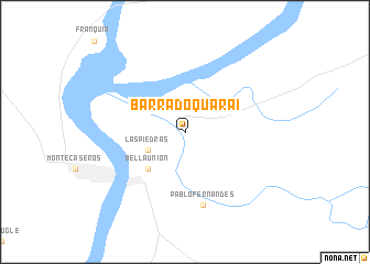
Barra do Quaraí (Rio Grande do Sul, Brazil)Barra do Quaraí is a town in the Rio Grande do Sul region of Brazil. An overview map of the region around Barra do Quaraí is displayed below.
regional and 3d topo map of Barra do Quaraí, Brazil ::
Barra do Quaraí airports ::
The nearest airport is URG - Uruguaiana Rubem Berta, located 69.0 km north east of Barra do Quaraí.
Other airports nearby include AOL - Paso De Los Libres (69.9 km north east), COC - Concordia Comodoro Pierrestegui (127.2 km south), STY - Salto Nueva Hesperides Intl (141.7 km south), Nearby towns ::
Las Piedras (3.7km south west) //
Bella Unión (4.9km south west) //
Pablo Fernandes (7.6km south) //
[all distances 'as the bird flies' and approximate]  Places with similar names to Barra do Quaraí, Brazil ::
// Bertigaro (IT)
// Brattåker (NO)
// Bard-e Gūrī (IR)
// Bardehkar (IR)
// Broadacre (US)
// Bri Ātkaria (BD)
// Bara Digar (IN)
// Berdikari (ID)
// Berdikari (ID)
// Bråtåkra (SE)
Disclaimer :: Information on this page comes without warranty of any kind |
||
|
Where is Barra do Quaraí? Elevation and coordinates ::
Latitude (lat): 30°13'0"S Longitude (lon): 57°33'0"W
Elevation (approx.): 45m (map arrows pan, magnifying glasses zoom) |
||
|
Visiting Barra do Quaraí? Hotel/Accommodation ::
Book a hotel in Barra do Quaraí Travel Guide ::
Buy a travel guide for Brazil rental cars ::
car rental offers GPS waypoint ::
download a GPX waypoint (PoI) of Barra do Quaraí for your GPS receiver
|
||