|
search place name
|
||
Bonfim (Rio Grande do Norte, Brazil)Bonfim is a town in the Rio Grande do Norte region of Brazil. An overview map of the region around Bonfim is displayed below.
regional and 3d topo map of Bonfim, Brazil ::

Bonfim airports ::
The nearest airport is NAT - Natal Augusto Severo, located 147.0 km east of Bonfim.
Other airports nearby include CPV - Campina Grande Presidente Joao Suassuna (160.7 km south east), JPA - Joao Pessoa Presidente Castro Pinto (220.9 km south east), Nearby towns ::
São Francisco (4.3km east) //
Pau dʼArco (4.3km north) //
Cabeço de João Ferino (4.8km west) //
São José da Passagem (6.0km south west) //
Jardim (6.1km north west) //
Camarão (8.0km north east) //
Serra do Gado (9.2km north east) //
Santana do Matos (9.3km west) //
Santa Teresa (9.4km north west) //
[all distances 'as the bird flies' and approximate] 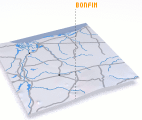 Places with similar names to Bonfim, Brazil ::
// Bönnigheim (DE)
// Benafim (PT)
// Ban Fai Mai (TH)
// Ban Fam (TH)
// Ban Fa Mui (TH)
// Ban I Phum (TH)
// Ban Phae Mai (TH)
// Ban Phai Mu (TH)
// Ban Pham (TH)
// Ban Pham (TH)
Disclaimer :: Information on this page comes without warranty of any kind |
||
|
Where is Bonfim? Elevation and coordinates ::
Latitude (lat): 5°59'3"S Longitude (lon): 36°34'25"W
Elevation (approx.): 207m (map arrows pan, magnifying glasses zoom) |
||
|
Visiting Bonfim? Hotel/Accommodation ::
Book a hotel in Bonfim Travel Guide ::
Buy a travel guide for Brazil rental cars ::
car rental offers GPS waypoint ::
download a GPX waypoint (PoI) of Bonfim for your GPS receiver
|
||