|
search place name
|
||
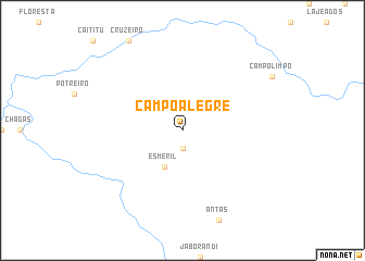
Campo Alegre (São Paulo, Brazil)Campo Alegre is a town in the São Paulo region of Brazil. An overview map of the region around Campo Alegre is displayed below.
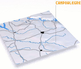
regional and 3d topo map of Campo Alegre, Brazil ::
Campo Alegre airports ::
The nearest airport is RAO - Ribeirao Preto Leite Lopes, located 64.1 km south west of Campo Alegre.
Other airports nearby include QPS - Piracununga Campo Fontenelle (133.1 km south), UBA - Uberaba (133.3 km north west), POO - Pocos De Caldas (138.8 km south east), AQA - Araracuara Araraquara (144.0 km south west), Nearby towns ::
 Places with similar names to Campo Alegre, Brazil ::
// Campo Alegre (PA)
// Campo Alegre (PA)
// Campo Alegre (CU)
// Campo Alegre (CU)
// Campo Alegre (CO)
// Campo Alegre (CO)
// Campo Alegre (CO)
// Campo Alegre (CO)
// Campo Alegre (CO)
// Campo Alegre (CO)
Disclaimer :: Information on this page comes without warranty of any kind |
||
|
Where is Campo Alegre? Elevation and coordinates ::
Latitude (lat): 20°47'0"S Longitude (lon): 47°17'0"W
Elevation (approx.): 798m (map arrows pan, magnifying glasses zoom) |
||
|
Visiting Campo Alegre? Hotel/Accommodation ::
Book a hotel in Campo Alegre Travel Guide ::
Buy a travel guide for Brazil rental cars ::
car rental offers GPS waypoint ::
download a GPX waypoint (PoI) of Campo Alegre for your GPS receiver
|
||