|
search place name
|
||
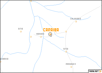
Caraíba (Bahia, Brazil)Caraíba is a town in the Bahia region of Brazil. An overview map of the region around Caraíba is displayed below.
regional and 3d topo map of Caraíba, Brazil ::
Caraíba airports ::
The nearest airport is PAV - Paulo Alfonso Paulo Afonso, located 74.0 km east of Caraíba.
Other airports nearby include PNZ - Petrolina Senador Nilo Coelho (182.1 km west), AJU - Aracaju Santa Maria (260.5 km south east), Nearby towns ::
Quirino (2.6km north east) //
Mariana (3.7km west) //
São Francisco (5.8km east) //
Várzea da Ema (7.3km west) //
Sítio (7.8km south east) //
[all distances 'as the bird flies' and approximate] 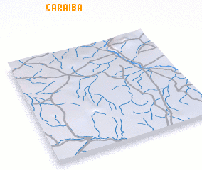 Places with similar names to Caraíba, Brazil ::
Disclaimer :: Information on this page comes without warranty of any kind |
||
|
Where is Caraíba? Elevation and coordinates ::
Latitude (lat): 9°30'0"S Longitude (lon): 38°55'0"W
Elevation (approx.): 408m (map arrows pan, magnifying glasses zoom) |
||
|
Visiting Caraíba? Hotel/Accommodation ::
Book a hotel in Caraíba Travel Guide ::
Buy a travel guide for Brazil rental cars ::
car rental offers GPS waypoint ::
download a GPX waypoint (PoI) of Caraíba for your GPS receiver
|
||