|
search place name
|
||
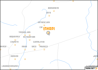
Inhapi (Alagoas, Brazil)Inhapi is a town in the Alagoas region of Brazil. An overview map of the region around Inhapi is displayed below.
regional and 3d topo map of Inhapi, Brazil ::
Inhapi airports ::
The nearest airport is PAV - Paulo Alfonso Paulo Afonso, located 58.0 km west of Inhapi.
Other airports nearby include AJU - Aracaju Santa Maria (207.5 km south), MCZ - Maceio Zumbi Dos Palmares (217.3 km east), CPV - Campina Grande Presidente Joao Suassuna (298.1 km north east), Nearby towns ::
Camarão (2.6km north west) //
Mata Escura (4.1km north west) //
Curralinho (5.2km south west) //
Pau Sêco (5.9km south) //
Gato (7.4km north) //
Salgadinho (7.3km west) //
Alto do Peba (7.5km west) //
Saco (7.8km south west) //
[all distances 'as the bird flies' and approximate] 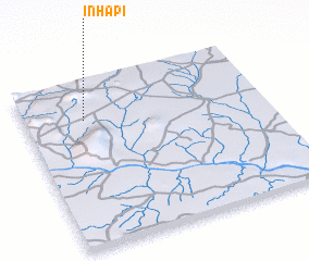 Places with similar names to Inhapi, Brazil :: Disclaimer :: Information on this page comes without warranty of any kind |
||
|
Where is Inhapi? Elevation and coordinates ::
Latitude (lat): 9°14'0"S Longitude (lon): 37°45'0"W
Elevation (approx.): 381m (map arrows pan, magnifying glasses zoom) |
||
|
Visiting Inhapi? Hotel/Accommodation ::
Book a hotel in Inhapi Travel Guide ::
Buy a travel guide for Brazil rental cars ::
car rental offers GPS waypoint ::
download a GPX waypoint (PoI) of Inhapi for your GPS receiver
|
||