|
search place name
|
||
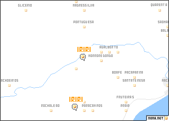
Iriri (Rio de Janeiro, Brazil)Iriri is a town in the Rio de Janeiro region of Brazil. An overview map of the region around Iriri is displayed below.
regional and 3d topo map of Iriri, Brazil ::
Iriri airports ::
The nearest airport is CAW - Campos Bartolomeu Lisandro, located 97.1 km north east of Iriri.
Other airports nearby include SDU - Rio De Janeiro Santos Dumont (140.1 km south west), GIG - Rio De Janeiro Galeao Antonio Carlos Jobim (143.1 km west), JDF - Juiz De Fora Francisco De Assis (160.0 km west), STU - Rio De Janeiro Santa Cruz (193.6 km west), Nearby towns ::
Belmonte (2.5km south west) //
Morro Redondo (3.4km east) //
Pedrinhas (3.9km north east) //
Adalberto (5.5km east) //
Portuguêsa (7.4km north) //
Cachoeiras (7.1km east) //
Boa Fé (7.8km south east) //
[all distances 'as the bird flies' and approximate] 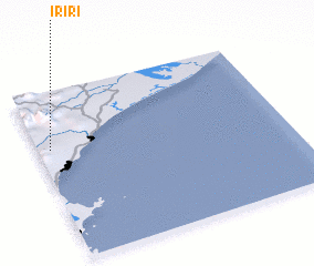 Places with similar names to Iriri, Brazil ::
Disclaimer :: Information on this page comes without warranty of any kind |
||
|
Where is Iriri? Elevation and coordinates ::
Latitude (lat): 22°20'0"S Longitude (lon): 41°57'0"W
Elevation (approx.): 66m (map arrows pan, magnifying glasses zoom) |
||
|
Visiting Iriri? Hotel/Accommodation ::
Book a hotel in Iriri Travel Guide ::
Buy a travel guide for Brazil rental cars ::
car rental offers GPS waypoint ::
download a GPX waypoint (PoI) of Iriri for your GPS receiver
|
||