|
search place name
|
||
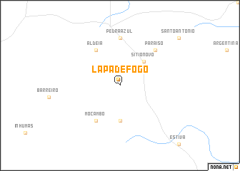
Lapa de Fogo (Minas Gerais, Brazil)Lapa de Fogo is a town in the Minas Gerais region of Brazil. An overview map of the region around Lapa de Fogo is displayed below.
regional and 3d topo map of Lapa de Fogo, Brazil ::
Nearby towns ::
Sítio Novo (5.1km north east) //
Deocleciano Faria (5.6km south) //
Aldeia (6.6km north west) //
Mocambo (6.6km south west) //
Pedra Azul (7.4km north) //
Paraíso (7.7km north east) //
[all distances 'as the bird flies' and approximate]  Places with similar names to Lapa de Fogo, Brazil ::
Disclaimer :: Information on this page comes without warranty of any kind |
||
|
Where is Lapa de Fogo? Elevation and coordinates ::
Latitude (lat): 16°5'0"S Longitude (lon): 41°16'0"W
Elevation (approx.): 702m (map arrows pan, magnifying glasses zoom) |
||
|
Visiting Lapa de Fogo? Hotel/Accommodation ::
Book a hotel in Lapa de Fogo Travel Guide ::
Buy a travel guide for Brazil rental cars ::
car rental offers GPS waypoint ::
download a GPX waypoint (PoI) of Lapa de Fogo for your GPS receiver
|
||