|
search place name
|
||
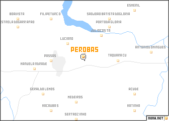
Perobas (Minas Gerais, Brazil)Perobas is a town in the Minas Gerais region of Brazil. An overview map of the region around Perobas is displayed below.
regional and 3d topo map of Perobas, Brazil ::
Perobas airports ::
The nearest airport is POO - Pocos De Caldas, located 124.7 km south of Perobas.
Other airports nearby include RAO - Ribeirao Preto Leite Lopes (135.5 km west), VAG - Varginha Major Brigadeiro Trompowsky (147.8 km south east), QPS - Piracununga Campo Fontenelle (162.3 km south west), UBA - Uberaba (181.5 km north west), Nearby towns ::
Vilela (1.9km north) //
Luciano (5.1km north west) //
Júlio Costa (6.6km north east) //
Taquaraçu (6.9km east) //
Passos (6.9km west) //
Pôrto da Glória (9.1km north east) //
[all distances 'as the bird flies' and approximate]  Places with similar names to Perobas, Brazil ::
Disclaimer :: Information on this page comes without warranty of any kind |
||
|
Where is Perobas? Elevation and coordinates ::
Latitude (lat): 20°43'0"S Longitude (lon): 46°33'0"W
Elevation (approx.): 821m (map arrows pan, magnifying glasses zoom) |
||
|
Visiting Perobas? Hotel/Accommodation ::
Book a hotel in Perobas Travel Guide ::
Buy a travel guide for Brazil rental cars ::
car rental offers GPS waypoint ::
download a GPX waypoint (PoI) of Perobas for your GPS receiver
|
||