|
search place name
|
||
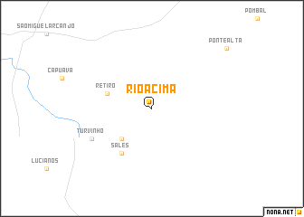
Rio Acima (São Paulo, Brazil)Rio Acima is a town in the São Paulo region of Brazil. An overview map of the region around Rio Acima is displayed below.
regional and 3d topo map of Rio Acima, Brazil ::
Rio Acima airports ::
The nearest airport is CGH - Sao Paulo Congonhas, located 129.1 km east of Rio Acima.
Other airports nearby include VCP - Campinas Viracopos (129.9 km north east), GRU - Sao Paulo Guarulhos Gov Andre Franco Montouro (154.3 km east), SSZ - Base Aerea De Santos (160.8 km east), BFH - Curitiba Bacacheri (210.9 km south west), Nearby towns ::
Sumidouro de Cima (5.0km south west) //
Retiro (5.4km west) //
Sales (6.5km south west) //
Turvinho (7.7km south west) //
[all distances 'as the bird flies' and approximate] 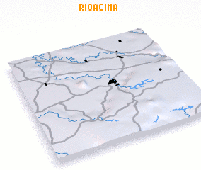 Places with similar names to Rio Acima, Brazil ::
Disclaimer :: Information on this page comes without warranty of any kind |
||
|
Where is Rio Acima? Elevation and coordinates ::
Latitude (lat): 23°58'0"S Longitude (lon): 47°52'0"W
Elevation (approx.): 717m (map arrows pan, magnifying glasses zoom) |
||
|
Visiting Rio Acima? Hotel/Accommodation ::
Book a hotel in Rio Acima Travel Guide ::
Buy a travel guide for Brazil rental cars ::
car rental offers GPS waypoint ::
download a GPX waypoint (PoI) of Rio Acima for your GPS receiver
|
||