|
search place name
|
||
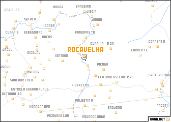
Roça Velha (Maranhão, Brazil)Roça Velha is a town in the Maranhão region of Brazil. An overview map of the region around Roça Velha is displayed below.
regional and 3d topo map of Roça Velha, Brazil ::
Roça Velha airports ::
The nearest airport is THE - Teresina Senador Petronio Portella, located 162.4 km south of Roça Velha.
Other airports nearby include SLZ - Sao Luis Marechal Cunha Machado Intl (178.0 km north west), Nearby towns ::
Albino (1.0km south east) //
Saquinho (1.3km north west) //
Carnaúba (2.2km south) //
Bastos (2.3km north west) //
Vereda (3.6km north west) //
Guarimã (3.9km north east) //
Campestre (3.9km south east) //
Picada (4.3km south east) //
Bastos (4.5km north) //
Matinha (5.1km west) //
Fim do Pasto (5.2km north) //
Ingá (6.2km north east) //
Acampamento (6.2km south east) //
Rio Preto II (6.5km south) //
Santa Maria (7.5km west) //
Canto dos Negros (7.9km south) //
Cláudio (7.9km north) //
Lagoa dʼÁgua (8.0km west) //
Centro dos Teixeiras (8.2km south east) //
Jibóia (8.4km north) //
Buritirana (8.5km south east) //
Poços (9.3km north west) //
Pau Preto (9.5km south east) //
Angical (10.1km north west) //
Moraes (10.3km north west) //
[all distances 'as the bird flies' and approximate]  Places with similar names to Roça Velha, Brazil ::
// Roça Velha (BR)
// Roça Velha (BR)
// Roça Velha (BR)
// Roça Velha (BR)
// Roça Velha (BR)
// Roça Velha (BR)
Disclaimer :: Information on this page comes without warranty of any kind |
||
|
Where is Roça Velha? Elevation and coordinates ::
Latitude (lat): 3°36'5"S Longitude (lon): 42°59'32"W
Elevation (approx.): 78m (map arrows pan, magnifying glasses zoom) |
||
|
Visiting Roça Velha? Hotel/Accommodation ::
Book a hotel in Roça Velha Travel Guide ::
Buy a travel guide for Brazil rental cars ::
car rental offers GPS waypoint ::
download a GPX waypoint (PoI) of Roça Velha for your GPS receiver
|
||