|
search place name
|
||
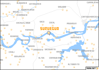
Suruégua (Piauí, Brazil)Suruégua is a town in the Piauí region of Brazil. An overview map of the region around Suruégua is displayed below.
regional and 3d topo map of Suruégua, Brazil ::
Suruégua airports ::
The nearest airport is THE - Teresina Senador Petronio Portella, located 187.0 km south of Suruégua.
Other airports nearby include SLZ - Sao Luis Marechal Cunha Machado Intl (232.3 km north west), Nearby towns ::
Moquém (1.9km south west) //
Timóteo (2.3km south east) //
Salto da Pedra (2.9km east) //
Chapéu de Couro (3.1km west) //
Cocal (3.8km north) //
Cantinho (4.0km south west) //
Porto das Vargens (4.3km south east) //
Canto da Catinga (4.4km south west) //
Saco (4.7km north west) //
Luzilândia (5.1km south west) //
Porto Formoso (5.2km west) //
Saquinho (5.2km south west) //
Porto da Melancia (5.5km east) //
Vaquejador (6.6km north east) //
Saco Danta (6.7km south) //
Formosa (7.4km west) //
Boca da Barra II (7.5km west) //
Melancia (7.7km east) //
Candeeiro (8.0km south west) //
Angelim (8.6km south east) //
Tapera (8.7km south west) //
Pau-dʼÁgua (9.2km east) //
Vassouras (9.6km south west) //
Muricizinho (10.7km south east) //
São Bernardo (11.8km north west) //
[all distances 'as the bird flies' and approximate] 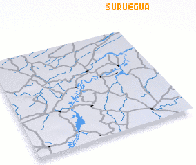 Places with similar names to Suruégua, Brazil ::
Disclaimer :: Information on this page comes without warranty of any kind |
||
|
Where is Suruégua? Elevation and coordinates ::
Latitude (lat): 3°26'38"S Longitude (lon): 42°19'37"W
Elevation (approx.): 17m (map arrows pan, magnifying glasses zoom) |
||
|
Visiting Suruégua? Hotel/Accommodation ::
Book a hotel in Suruégua Travel Guide ::
Buy a travel guide for Brazil rental cars ::
car rental offers GPS waypoint ::
download a GPX waypoint (PoI) of Suruégua for your GPS receiver
|
||