|
search place name
|
||
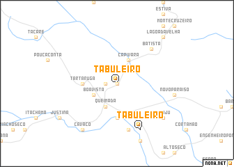
Tabuleiro (Bahia, Brazil)Tabuleiro is a town in the Bahia region of Brazil. An overview map of the region around Tabuleiro is displayed below.
regional and 3d topo map of Tabuleiro, Brazil ::
Tabuleiro airports ::
The nearest airport is SSA - Salvador Deputado Luis Eduardo Magalhaes, located 137.9 km east of Tabuleiro.
Other airports nearby include IOS - Ilheus (211.8 km south), Nearby towns ::
Brondó (0.0km north) //
Lagoa da Queimada (0.0km north) //
Gentio do Meio (1.8km west) //
Boa Vista (4.1km south west) //
Capivara (4.1km north east) //
Diógenes Sampaio (4.1km north east) //
Queimada (4.1km south west) //
Tartaruga (5.4km west) //
Amargosa (5.6km south) //
Palmeira (7.6km south) //
Batista (7.8km north east) //
Tabuleiro (8.2km south east) //
Cavaco (9.2km south west) //
Acaju (9.1km south east) //
Lagoa da Velha (10.4km north east) //
[all distances 'as the bird flies' and approximate]  Places with similar names to Tabuleiro, Brazil ::
// Tebeler (RU)
// Döbler (DE)
// Tabler (US)
// Deibler (US)
// Diébel Loro (SN)
// Tabalara (GN)
// Taʼ Bullara (MT)
// Tabuleiro (BR)
// Tabuleirão (BR)
// Tabuleiro (BR)
Disclaimer :: Information on this page comes without warranty of any kind |
||
|
Where is Tabuleiro? Elevation and coordinates ::
Latitude (lat): 12°59'0"S Longitude (lon): 39°36'0"W
Elevation (approx.): 397m (map arrows pan, magnifying glasses zoom) |
||
|
Visiting Tabuleiro? Hotel/Accommodation ::
Book a hotel in Tabuleiro Travel Guide ::
Buy a travel guide for Brazil rental cars ::
car rental offers GPS waypoint ::
download a GPX waypoint (PoI) of Tabuleiro for your GPS receiver
|
||