|
search place name
|
||
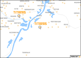
Titaras (Piauí, Brazil)Titaras is a town in the Piauí region of Brazil. An overview map of the region around Titaras is displayed below.
regional and 3d topo map of Titaras, Brazil ::
Titaras airports ::
The nearest airport is THE - Teresina Senador Petronio Portella, located 118.5 km south of Titaras.
Other airports nearby include SLZ - Sao Luis Marechal Cunha Machado Intl (227.5 km north west), Nearby towns ::
Pedras (3.7km east) //
Saco (4.9km north east) //
Pilões (5.1km north) //
Pôrto Estanhado (5.5km north west) //
Peador (5.5km east) //
Barra Nova (6.6km north west) //
Ponta-dʼÁgua (7.6km east) //
Pé-do-Morro (7.8km north east) //
Nossa Senhora dos Remédios (8.3km east) //
Morada Nova (9.3km north west) //
Saguões (9.6km north west) //
Bandá (10.6km north west) //
Estiva (11.0km north east) //
[all distances 'as the bird flies' and approximate] 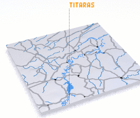 Places with similar names to Titaras, Brazil ::
Disclaimer :: Information on this page comes without warranty of any kind |
||
|
Where is Titaras? Elevation and coordinates ::
Latitude (lat): 3°59'31"S Longitude (lon): 42°44'27"W
Elevation (approx.): 45m (map arrows pan, magnifying glasses zoom) |
||
|
Visiting Titaras? Hotel/Accommodation ::
Book a hotel in Titaras Travel Guide ::
Buy a travel guide for Brazil rental cars ::
car rental offers GPS waypoint ::
download a GPX waypoint (PoI) of Titaras for your GPS receiver
|
||