|
search place name
|
||
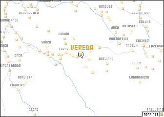
Vereda (Maranhão, Brazil)Vereda is a town in the Maranhão region of Brazil. An overview map of the region around Vereda is displayed below.
regional and 3d topo map of Vereda, Brazil ::
Vereda airports ::
The nearest airport is THE - Teresina Senador Petronio Portella, located 126.6 km south of Vereda.
Other airports nearby include SLZ - Sao Luis Marechal Cunha Machado Intl (193.4 km north west), Nearby towns ::
Sanharão (1.2km north west) //
Macajuba (1.6km east) //
Mundo Novo (2.1km south) //
Bica (2.2km north east) //
Malhada (2.2km west) //
Carnaubinha (2.9km west) //
Mata Velha (4.0km south east) //
Campo Redondo (4.1km west) //
Santa Luzia (4.7km north east) //
Baixão do Cedro (4.8km west) //
Atoleiro de Dentro (4.9km north) //
Sobradinho (5.0km west) //
Atoleiro (5.1km north west) //
Frigideira (5.2km west) //
Folha Larga (5.4km west) //
Brejinho (5.9km east) //
Baixão (6.0km north west) //
Campestre (6.3km west) //
Bananal (6.3km south east) //
Lacre (6.8km west) //
Varginha (7.3km west) //
Paulo (7.9km west) //
São Benedito (8.0km west) //
Souza (8.4km west) //
Cigano (9.0km west) //
Riacho Feio I (9.2km east) //
Jacu (9.8km north east) //
Tamboril Grosso (9.9km north west) //
[all distances 'as the bird flies' and approximate] 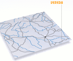 Places with similar names to Vereda, Brazil ::
Disclaimer :: Information on this page comes without warranty of any kind |
||
|
Where is Vereda? Elevation and coordinates ::
Latitude (lat): 3°58'6"S Longitude (lon): 43°10'7"W
Elevation (approx.): 79m (map arrows pan, magnifying glasses zoom) |
||
|
Visiting Vereda? Hotel/Accommodation ::
Book a hotel in Vereda Travel Guide ::
Buy a travel guide for Brazil rental cars ::
car rental offers GPS waypoint ::
download a GPX waypoint (PoI) of Vereda for your GPS receiver
|
||