|
search place name
|
||
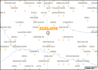
Agadjamé (Togo)Agadjamé is a town in Togo. An overview map of the region around Agadjamé is displayed below.
regional and 3d topo map of Agadjamé, Togo ::
Agadjamé airports ::
The nearest airport is LFW - Lome Gnassingbe Eyadema Intl, located 118.5 km south of Agadjamé.
Other airports nearby include COO - Cotonou Cadjehoun (165.8 km south east), ACC - Accra Kotoka Intl (232.8 km south west), Nearby towns ::
Adanka (1.9km north) //
Karigora (3.7km south) //
Niamtougou (3.7km south) //
Kpambiribi (4.1km south east) //
Bato (4.1km south west) //
Kougnohou (4.1km south west) //
Pogan (4.1km north east) //
Zinnglakopé (4.1km north west) //
Onétékopé (5.2km north west) //
Kra (5.6km south) //
Tatrakondji (5.6km south) //
Agoto (5.8km east) //
Amouzoukopé (5.9km south) //
Dokochroé (5.8km east) //
Kooda (7.6km south) //
Lossokopé (7.6km east) //
Zolou (7.6km north) //
Arengbo (7.8km north west) //
Gotakablé (8.3km south east) //
Gota (8.3km south east) //
Atakpara (8.2km north east) //
Gnaguidikopé (8.3km north east) //
Lémokopé (9.2km south west) //
Kablékpégnon (9.2km south west) //
Boébé (9.2km north east) //
Ayolé (9.2km north west) //
Baladjékopé (9.2km north east) //
[all distances 'as the bird flies' and approximate] 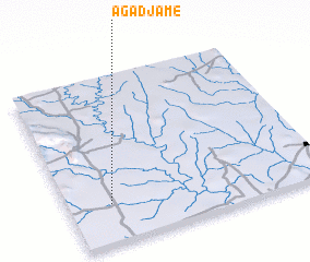 Places with similar names to Agadjamé, Togo ::
// Acadjamé (BJ)
Disclaimer :: Information on this page comes without warranty of any kind |
||
|
Where is Agadjamé? Elevation and coordinates ::
Latitude (lat): 7°14'0"N Longitude (lon): 1°10'0"E
Elevation (approx.): 175m (map arrows pan, magnifying glasses zoom) |
||
|
Visiting Agadjamé? Hotel/Accommodation ::
Book a hotel in Agadjamé Travel Guide ::
Buy a travel guide for Togo rental cars ::
car rental offers GPS waypoint ::
download a GPX waypoint (PoI) of Agadjamé for your GPS receiver
|
||