|
search place name
|
||
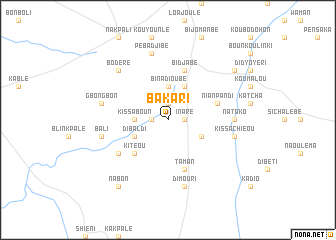
Bakari (Togo)Bakari is a town in Togo. An overview map of the region around Bakari is displayed below.
regional and 3d topo map of Bakari, Togo ::
Bakari airports ::
The nearest airport is LRL - Niatougou Niamtougou International, located 79.9 km north east of Bakari.
Other airports nearby include TML - Tamale (160.3 km west), Nearby towns ::
Inaré (1.8km east) //
Bissokpabé (1.9km north) //
Yachiboulé (1.8km west) //
Binadioubé (3.7km north) //
Bakpaya (3.7km west) //
Kissaboun (3.7km west) //
Béssarakpenbé (4.1km north east) //
Binatapé (4.1km south east) //
Bidaïbé (4.1km south west) //
Dibaldi (4.1km south west) //
Kitéou (5.2km south west) //
Nianpandi (5.8km east) //
Taman (5.9km south) //
Bidjabé (5.9km north) //
Kpajaba (6.6km south west) //
Apoeydoumpo (7.3km east) //
Natako (7.3km east) //
Pebadjibé (7.6km north) //
Kissachiéou (7.5km east) //
Gbongbon (7.5km west) //
Dimouri (7.6km south) //
Bali (7.5km west) //
Bodere (7.8km north west) //
Baoulinsé (9.2km north east) //
Nabon (9.2km south west) //
[all distances 'as the bird flies' and approximate] 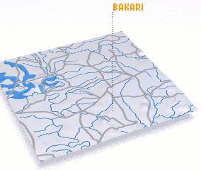 Places with similar names to Bakari, Togo ::
Disclaimer :: Information on this page comes without warranty of any kind |
||
|
Where is Bakari? Elevation and coordinates ::
Latitude (lat): 9°16'0"N Longitude (lon): 0°34'0"W
Elevation (approx.): 229m (map arrows pan, magnifying glasses zoom) |
||
|
Visiting Bakari? Hotel/Accommodation ::
Book a hotel in Bakari Travel Guide ::
Buy a travel guide for Togo rental cars ::
car rental offers GPS waypoint ::
download a GPX waypoint (PoI) of Bakari for your GPS receiver
|
||