|
search place name
|
||
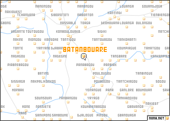
Batanbouaré (Togo)Batanbouaré is a town in Togo. An overview map of the region around Batanbouaré is displayed below.
regional and 3d topo map of Batanbouaré, Togo ::
Batanbouaré airports ::
The nearest airport is LRL - Niatougou Niamtougou International, located 149.3 km south east of Batanbouaré.
Other airports nearby include TML - Tamale (184.0 km south west), OUA - Ouagadougou (255.2 km north west), Nearby towns ::
Pana Bagou (1.9km south) //
Dapanpergou (2.6km north west) //
Badoré (2.6km north west) //
Naboague (2.6km south east) //
Djangou (2.6km south east) //
Boundjouaré (3.6km east) //
Batémané (4.1km south east) //
Parbiak (4.1km south east) //
Pana Kounkogo (4.1km south east) //
Tantigou (5.2km north west) //
Bomongue (5.2km north west) //
Ourgou Tigou (5.2km north west) //
Tantouagou (5.2km north east) //
Natala (5.2km south east) //
Poulougou (5.2km south east) //
Nadégré (5.5km west) //
Babona (5.5km east) //
Djabargou (5.8km west) //
Parbiak (5.8km east) //
Naloague (5.9km south) //
Dapaong (6.1km north west) //
Konboulouaka (6.6km north west) //
Sidiki (6.6km north east) //
Poubogou (6.6km south east) //
Toaga (7.4km north) //
Gouani (7.3km west) //
Tangbaré (7.3km east) //
Konbogou (7.4km south) //
Kountongbong (7.6km north) //
[all distances 'as the bird flies' and approximate]  Places with similar names to Batanbouaré, Togo ::
// Batinabura (PG)
Disclaimer :: Information on this page comes without warranty of any kind |
||
|
Where is Batanbouaré? Elevation and coordinates ::
Latitude (lat): 10°49'0"N Longitude (lon): 0°14'0"W
Elevation (approx.): 280m (map arrows pan, magnifying glasses zoom) |
||
|
Visiting Batanbouaré? Hotel/Accommodation ::
Book a hotel in Batanbouaré Travel Guide ::
Buy a travel guide for Togo rental cars ::
car rental offers GPS waypoint ::
download a GPX waypoint (PoI) of Batanbouaré for your GPS receiver
|
||