|
search place name
|
||
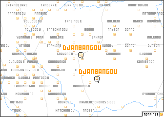
Djanbangou (Togo)Djanbangou is a town in Togo. An overview map of the region around Djanbangou is displayed below.
regional and 3d topo map of Djanbangou, Togo ::
Djanbangou airports ::
The nearest airport is LRL - Niatougou Niamtougou International, located 131.6 km south east of Djanbangou.
Other airports nearby include TML - Tamale (186.0 km south west), OUA - Ouagadougou (273.5 km north west), Nearby towns ::
Biégou (0.0km north) //
Naki-Est (0.7km north) //
Tamondjouaré (1.8km west) //
Batébogou (2.6km north west) //
Gbawanga (3.6km west) //
Napirkang (3.7km south) //
Titiégou (3.7km south) //
Boumouan (4.1km north west) //
Doubouak (4.1km south west) //
Sawaga (5.2km north east) //
Nabinga (5.2km south east) //
Napabagou (5.6km north) //
Fobanga (5.6km north) //
Konkon (5.9km south) //
Tankiarékou (5.8km west) //
Péoungou (5.8km east) //
Sogou (5.9km north) //
Gbanouaga (5.8km west) //
Nabangou (5.9km north) //
Djapiengou (5.9km north) //
Djanbangou (6.6km south east) //
Ganloré (6.6km north west) //
Touangou (6.6km south west) //
Padouane (6.6km south west) //
Goubouni (7.3km east) //
Kpinbonga (7.4km south) //
Kondjouaré (7.5km east) //
Djatougou (7.6km north) //
Tanbingué (7.6km north) //
[all distances 'as the bird flies' and approximate]  Places with similar names to Djanbangou, Togo ::
// Djanbangou (TG)
Disclaimer :: Information on this page comes without warranty of any kind |
||
|
Where is Djanbangou? Elevation and coordinates ::
Latitude (lat): 10°43'0"N Longitude (lon): 0°22'0"W
Elevation (approx.): 269m (map arrows pan, magnifying glasses zoom) |
||
|
Visiting Djanbangou? Hotel/Accommodation ::
Book a hotel in Djanbangou Travel Guide ::
Buy a travel guide for Togo rental cars ::
car rental offers GPS waypoint ::
download a GPX waypoint (PoI) of Djanbangou for your GPS receiver
|
||