|
search place name
|
||
Dote (Togo)Dote is a town in Togo. An overview map of the region around Dote is displayed below.
regional and 3d topo map of Dote, Togo ::

Dote airports ::
The nearest airport is LRL - Niatougou Niamtougou International, located 143.3 km south east of Dote.
Other airports nearby include TML - Tamale (170.7 km south west), OUA - Ouagadougou (260.1 km north west), Nearby towns ::
Samboumé (0.0km north) //
Nadjok (1.8km west) //
Kpankpark (1.9km south) //
Sagou (1.9km south) //
Goundoga (2.6km south west) //
Louanou (2.6km south east) //
Bombouaka (2.6km east) //
Sankpong (3.6km west) //
Kong Kpintingué (4.1km south west) //
Kangou (4.1km south west) //
Nandodani (4.1km south east) //
Nassiété (4.1km north west) //
Tanbangou (4.1km north east) //
Tandjouaré (5.1km south) //
Djapaké (5.2km south west) //
Sounsouri (5.2km north west) //
Nandoga (5.2km south east) //
Bogou (5.6km south) //
Djalogué (5.5km east) //
Kpierk (5.5km west) //
Sidjitré (5.9km south) //
Sagoudanhang (5.8km east) //
Koulogé (5.8km east) //
Bopaké (5.8km west) //
Djabiré (6.6km south west) //
Doklé (6.6km south west) //
Ganganakounkok (6.6km south east) //
Djaléré (6.6km north east) //
Kounkokou (7.4km south) //
[all distances 'as the bird flies' and approximate] 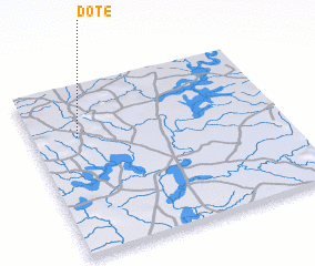 Places with similar names to Dote, Togo ::
Disclaimer :: Information on this page comes without warranty of any kind |
||
|
Where is Dote? Elevation and coordinates ::
Latitude (lat): 10°42'0"N Longitude (lon): 0°11'0"W
Elevation (approx.): 415m (map arrows pan, magnifying glasses zoom) |
||
|
Visiting Dote? Hotel/Accommodation ::
Book a hotel in Dote Travel Guide ::
Buy a travel guide for Togo rental cars ::
car rental offers GPS waypoint ::
download a GPX waypoint (PoI) of Dote for your GPS receiver
|
||