|
search place name
|
||
Messiobé (Togo)Messiobé is a town in Togo. An overview map of the region around Messiobé is displayed below.
regional and 3d topo map of Messiobé, Togo ::

Messiobé airports ::
The nearest airport is LFW - Lome Gnassingbe Eyadema Intl, located 82.9 km south east of Messiobé.
Other airports nearby include COO - Cotonou Cadjehoun (173.6 km east), ACC - Accra Kotoka Intl (177.4 km south west), Nearby towns ::
Kpovénou (1.9km south) //
Agokplamé (2.6km north west) //
Zozokondji (3.7km west) //
Djokounékopé (3.7km west) //
Kolo (3.7km east) //
Missahomé (3.7km east) //
Kpando (4.1km south east) //
Tokpo (5.2km south east) //
Fokpou (5.9km south) //
Wonougba Séva (7.4km south) //
Fokpo (7.6km south) //
Wouhokoué (7.8km north east) //
Agonpala (7.8km south east) //
Houmokodji (8.3km north west) //
Wonougba (8.3km south east) //
Kevikopé (9.2km north west) //
Agoué Kopé (9.2km south west) //
Korésséwa (9.2km south west) //
Ali Kodji (10.4km south west) //
Glèkové (10.4km south west) //
Doundoudjemé (10.4km north east) //
[all distances 'as the bird flies' and approximate] 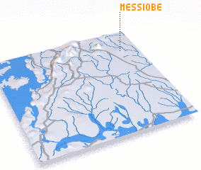 Places with similar names to Messiobé, Togo ::
Disclaimer :: Information on this page comes without warranty of any kind |
||
|
Where is Messiobé? Elevation and coordinates ::
Latitude (lat): 6°49'0"N Longitude (lon): 0°53'0"W
Elevation (approx.): 132m (map arrows pan, magnifying glasses zoom) |
||
|
Visiting Messiobé? Hotel/Accommodation ::
Book a hotel in Messiobé Travel Guide ::
Buy a travel guide for Togo rental cars ::
car rental offers GPS waypoint ::
download a GPX waypoint (PoI) of Messiobé for your GPS receiver
|
||