|
search place name
|
||
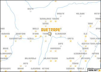
Ouétrapé (Togo)Ouétrapé is a town in Togo. An overview map of the region around Ouétrapé is displayed below.
regional and 3d topo map of Ouétrapé, Togo ::
Ouétrapé airports ::
The nearest airport is LFW - Lome Gnassingbe Eyadema Intl, located 138.8 km south east of Ouétrapé.
Other airports nearby include ACC - Accra Kotoka Intl (208.0 km south west), COO - Cotonou Cadjehoun (214.1 km south east), Nearby towns ::
Tinipé (1.8km west) //
Bogo Arlon (2.6km south west) //
Afiadégniba (2.6km north east) //
Illigo (3.7km west) //
Elavagnon (3.7km east) //
Dénou (4.1km north west) //
Dafo (5.2km south east) //
Dzogbégan (5.6km south) //
Babahoé (5.6km north) //
Ayoma (5.5km west) //
Ounadjassi (5.9km north) //
Mimpassem (5.9km south) //
Todomé (5.9km north) //
Baglo (5.8km west) //
Dzolu (7.6km west) //
Kpéto (7.6km east) //
Amouta (8.3km north east) //
[all distances 'as the bird flies' and approximate] 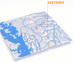 Places with similar names to Ouétrapé, Togo ::
Disclaimer :: Information on this page comes without warranty of any kind |
||
|
Where is Ouétrapé? Elevation and coordinates ::
Latitude (lat): 7°17'0"N Longitude (lon): 0°41'0"W
Elevation (approx.): 723m (map arrows pan, magnifying glasses zoom) |
||
|
Visiting Ouétrapé? Hotel/Accommodation ::
Book a hotel in Ouétrapé Travel Guide ::
Buy a travel guide for Togo rental cars ::
car rental offers GPS waypoint ::
download a GPX waypoint (PoI) of Ouétrapé for your GPS receiver
|
||