|
search place name
|
||
Pitambadé (Togo)Pitambadé is a town in Togo. An overview map of the region around Pitambadé is displayed below.
regional and 3d topo map of Pitambadé, Togo ::

Pitambadé airports ::
The nearest airport is LRL - Niatougou Niamtougou International, located 33.7 km north east of Pitambadé.
Other airports nearby include TML - Tamale (195.5 km west), Nearby towns ::
Kpéréa (1.9km south) //
Santé-Haut (4.1km south east) //
Santé-Bas (4.1km south west) //
Pessidé Koundoum (5.2km north west) //
Koundouta (5.5km west) //
Insalabou (5.6km south) //
Nièmpénou (5.8km west) //
Bassoudé (5.9km south) //
Wakadé (5.9km south) //
Haba (5.9km north) //
Kabanda (5.9km south) //
Kalia (6.7km south east) //
Nintambada (6.6km south east) //
Paktanga (6.7km north west) //
Bounkouloum (7.4km south) //
Kabanda (7.4km south) //
Kada (7.6km north) //
Baouda (7.5km east) //
Afoou (7.6km south) //
Tioutiou (7.8km north west) //
Bia (8.2km south east) //
Sondina (8.2km south east) //
Boussékou (9.2km south west) //
Tamémé (9.2km south west) //
Badao (9.2km south east) //
Kakourou (10.4km north west) //
[all distances 'as the bird flies' and approximate] 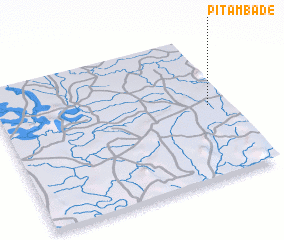 Places with similar names to Pitambadé, Togo ::
Disclaimer :: Information on this page comes without warranty of any kind |
||
|
Where is Pitambadé? Elevation and coordinates ::
Latitude (lat): 9°31'0"N Longitude (lon): 0°55'0"W
Elevation (approx.): 272m (map arrows pan, magnifying glasses zoom) |
||
|
Visiting Pitambadé? Hotel/Accommodation ::
Book a hotel in Pitambadé Travel Guide ::
Buy a travel guide for Togo rental cars ::
car rental offers GPS waypoint ::
download a GPX waypoint (PoI) of Pitambadé for your GPS receiver
|
||