|
search place name
|
||
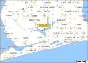
Pondaha (Togo)Pondaha is a town in Togo. An overview map of the region around Pondaha is displayed below.
regional and 3d topo map of Pondaha, Togo ::
Pondaha airports ::
The nearest airport is LFW - Lome Gnassingbe Eyadema Intl, located 36.9 km west of Pondaha.
Other airports nearby include COO - Cotonou Cadjehoun (90.8 km east), LOS - Lagos Murtala Muhammed (196.8 km east), ACC - Accra Kotoka Intl (206.1 km west), Nearby towns ::
Hounlokwé (0.0km north) //
Amédjonokou (1.9km south) //
Agnrokopé (1.9km south) //
Zowola Kpoguédé (1.8km east) //
Amento Kopé (1.8km west) //
Zowolagan (2.6km south east) //
Afidényigban (2.6km north east) //
Kwénou (3.7km south) //
Koyé Kopé (3.7km south) //
Agoumé (4.1km south east) //
Akoda (4.1km south west) //
Akwéta Kpégan (4.1km north east) //
Adabou Kopé (4.1km north west) //
Assoukopé (5.2km south east) //
Glidji (5.2km south east) //
Fyo Kondji (5.2km south east) //
Zalivé (5.2km south east) //
Glidji Kpodji (5.2km south east) //
Apéda Kondji (5.2km north west) //
Ayata (5.6km north) //
Gotivi (5.6km north) //
Tomé (5.6km north) //
Djankassé (5.6km south) //
Vogba (5.5km west) //
Adjégan Kopé (5.8km east) //
Sigbéwé (5.8km east) //
Togodo Azimaglé (5.9km north) //
Adjodogou (5.9km north) //
Klougakénou (5.8km east) //
[all distances 'as the bird flies' and approximate] 
Disclaimer :: Information on this page comes without warranty of any kind |
||
|
Where is Pondaha? Elevation and coordinates ::
Latitude (lat): 6°17'0"N Longitude (lon): 1°34'0"E
Elevation (approx.): -1m (map arrows pan, magnifying glasses zoom) |
||
|
Visiting Pondaha? Hotel/Accommodation ::
Book a hotel in Pondaha Travel Guide ::
Buy a travel guide for Togo rental cars ::
car rental offers GPS waypoint ::
download a GPX waypoint (PoI) of Pondaha for your GPS receiver
|
||