|
search place name
|
||
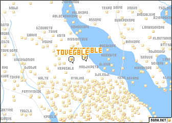
Tovégblé (Préfecture de Lomé, Togo)Tovégblé is a town in the Préfecture de Lomé region of Togo. An overview map of the region around Tovégblé is displayed below.
regional and 3d topo map of Tovégblé, Togo ::
Tovégblé airports ::
The nearest airport is LFW - Lome Gnassingbe Eyadema Intl, located 18.2 km south east of Tovégblé.
Other airports nearby include COO - Cotonou Cadjehoun (137.7 km east), ACC - Accra Kotoka Intl (163.3 km south west), Nearby towns ::
Kpéli Kopé (1.8km north west) //
Madjikpéto (2.1km south) //
Emoé Kopé (2.7km north) //
Tovégblé (2.8km west) //
Atyémé (4.1km south) //
Alinka (4.3km east) //
Sanyako (4.4km south) //
Mission-Tové (4.4km north west) //
Djosségblé (4.4km north west) //
Denliko (4.5km south) //
Atchyomé (4.6km south east) //
Diassékopé (4.7km west) //
Téfia (4.7km west) //
Nyalimé (4.9km south) //
Agbéli (5.0km south east) //
Agossito (5.0km east) //
Képégblé (5.0km south west) //
Sidémé (5.1km south) //
Agbodjalo (5.1km south east) //
Djilédji (5.1km south east) //
Komé (5.3km south east) //
Aoudé (5.4km south) //
Boga Kopé (5.4km north east) //
Sakpléto (5.4km south) //
Sanyra (5.5km south) //
Misino (5.6km south) //
Nyavi (5.6km south) //
Daliko (5.6km south) //
Amokwi (5.6km south east) //
[all distances 'as the bird flies' and approximate] 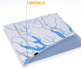
Disclaimer :: Information on this page comes without warranty of any kind |
||
|
Where is Tovégblé? Elevation and coordinates ::
Latitude (lat): 6°17'11"N Longitude (lon): 1°8'32"E
Elevation (approx.): 50m (map arrows pan, magnifying glasses zoom) |
||
|
Visiting Tovégblé? Hotel/Accommodation ::
Book a hotel in Tovégblé Travel Guide ::
Buy a travel guide for Togo rental cars ::
car rental offers GPS waypoint ::
download a GPX waypoint (PoI) of Tovégblé for your GPS receiver
|
||