|
search place name
|
||
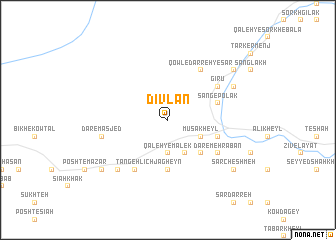
Dīvlān (Vardak, Afghanistan)Dīvlān is a town in the Vardak region of Afghanistan. An overview map of the region around Dīvlān is displayed below.
regional and 3d topo map of Dīvlān, Afghanistan ::
Dīvlān airports ::
The nearest airport is KBL - Kabul Intl, located 58.5 km east of Dīvlān.
Other airports nearby include JAA - Jalalabad (176.3 km east), Nearby towns ::
Qal‘eh-ye Malek (3.7km south) //
Sīāh Pītāv (4.0km south) //
Mūsá Kheyl (3.6km south east) //
Khar Walang (4.8km south east) //
Jāgheyn (5.6km south) //
Jalreyz (4.9km east) //
Tājekhā (4.9km east) //
Āhangarān (4.9km east) //
Sang-e Polak (4.9km east) //
Dar-e Mehrabān (5.9km south east) //
Tangeh Līch (6.3km south west) //
Qowl-e Darreh-ye Sār (6.3km north east) //
Baghalak (5.9km north east) //
Gīrū (5.9km north east) //
Dar-e Masjed (6.4km west) //
Bīborjak (7.2km south west) //
Qal‘eh-ye Shāh (7.1km north east) //
Qal‘eh-ye Sabz (8.3km south west) //
Sar Cheshmeh (8.3km south east) //
Qal‘eh-ye Sorkh-e Pā'īn (8.3km north east) //
[all distances 'as the bird flies' and approximate] 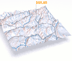 Places with similar names to Dīvlān, Afghanistan ::
Disclaimer :: Information on this page comes without warranty of any kind |
||
|
Where is Dīvlān? Elevation and coordinates ::
Latitude (lat): 34°29'0"N Longitude (lon): 68°35'0"E
Elevation (approx.): 2766m (map arrows pan, magnifying glasses zoom) |
||
|
Visiting Dīvlān? Hotel/Accommodation ::
Book a hotel in Dīvlān Travel Guide ::
Buy a travel guide for Afghanistan rental cars ::
car rental offers GPS waypoint ::
download a GPX waypoint (PoI) of Dīvlān for your GPS receiver
|
||