|
search place name
|
||
Jāmarj-e Bālā (Badakhshān, Afghanistan)Jāmarj-e Bālā is a town in the Badakhshān region of Afghanistan. An overview map of the region around Jāmarj-e Bālā is displayed below.
regional and 3d topo map of Jāmarj-e Bālā, Afghanistan ::
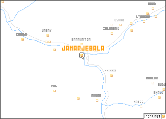
Nearby towns ::
Baravni Tor (3.4km north) //
Buniga (5.5km north west) //
Khikhik (6.2km south east) //
Dashtak (7.1km north west) //
Zelʼmabad (7.8km north east) //
Yeylāq-e Āmūrn (8.8km south) //
Vravuz (7.6km north west) //
Lyakhsh (7.6km north west) //
Rog (8.7km south west) //
Uabay (8.2km north west) //
Bichkhari (9.3km north east) //
Uskro (10.2km north east) //
[all distances 'as the bird flies' and approximate] 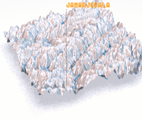 Places with similar names to Jāmarj-e Bālā, Afghanistan :: Disclaimer :: Information on this page comes without warranty of any kind |
||
|
Where is Jāmarj-e Bālā? Elevation and coordinates ::
Latitude (lat): 38°16'50"N Longitude (lon): 71°19'28"E
Elevation (approx.): 1614m (map arrows pan, magnifying glasses zoom) |
||
|
Visiting Jāmarj-e Bālā? Hotel/Accommodation ::
Book a hotel in Jāmarj-e Bālā Travel Guide ::
Buy a travel guide for Afghanistan rental cars ::
car rental offers GPS waypoint ::
download a GPX waypoint (PoI) of Jāmarj-e Bālā for your GPS receiver
|
||