|
search place name
|
||
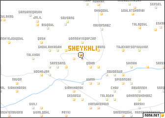
Sheykhlī (Vardak, Afghanistan)Sheykhlī is a town in the Vardak region of Afghanistan. An overview map of the region around Sheykhlī is displayed below.
regional and 3d topo map of Sheykhlī, Afghanistan ::
Sheykhlī airports ::
The nearest airport is KBL - Kabul Intl, located 133.4 km east of Sheykhlī.
Nearby towns ::
Sheykhkār (0.0km north) //
Khāk-e Pāyandeh (1.5km west) //
Qowbī (2.4km south east) //
Bārīk Jūy (2.4km south east) //
Darreh-ye Qaf Zār (3.7km north) //
Sar Band (3.6km north east) //
Zar Yāfteh (3.6km north east) //
Maghak (3.6km south east) //
Kārīz (3.6km north west) //
Lowrkhsanak (3.6km south west) //
Chūb Shāndeh (5.6km south) //
Wurnī (5.8km south) //
Altar Ghangak (4.9km west) //
Sar-e Sang (4.9km west) //
Bābah Khān (5.9km south east) //
Togha-ye Bangī (6.3km south east) //
Ghowlah Kadah (6.4km west) //
Noh Jūy (6.4km west) //
Sīāh Khārak (7.6km south) //
Nāvor Sabz (7.7km north east) //
Nāvor Sūp (7.2km south east) //
Gardan Deh (7.2km south west) //
Sīb Jūy (8.4km north) //
Savsang (8.9km north) //
Bīd Qowl (9.4km north west) //
Chāv (9.6km south east) //
[all distances 'as the bird flies' and approximate] 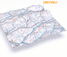 Places with similar names to Sheykhlī, Afghanistan ::
Disclaimer :: Information on this page comes without warranty of any kind |
||
|
Where is Sheykhlī? Elevation and coordinates ::
Latitude (lat): 34°27'0"N Longitude (lon): 67°46'0"E
Elevation (approx.): 3028m (map arrows pan, magnifying glasses zoom) |
||
|
Visiting Sheykhlī? Hotel/Accommodation ::
Book a hotel in Sheykhlī Travel Guide ::
Buy a travel guide for Afghanistan rental cars ::
car rental offers GPS waypoint ::
download a GPX waypoint (PoI) of Sheykhlī for your GPS receiver
|
||