|
search place name
|
||
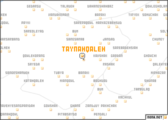
Taynah Qal‘eh (Vardak, Afghanistan)Taynah Qal‘eh is a town in the Vardak region of Afghanistan. An overview map of the region around Taynah Qal‘eh is displayed below.
regional and 3d topo map of Taynah Qal‘eh, Afghanistan ::
Taynah Qal‘eh airports ::
The nearest airport is KBL - Kabul Intl, located 129.6 km east of Taynah Qal‘eh.
Nearby towns ::
Qowl-e Chowlī ‘Olyā (0.0km north) //
Kavshak (3.1km east) //
Barakī (3.7km south) //
Sar-e Sarāb (4.0km north) //
Owzhay ‘Olyā (4.0km south) //
Dīwāl Qol (4.8km north east) //
Jū-ye Zangī (4.8km south west) //
Būm (5.8km north) //
Gongī (5.8km south) //
Rāshak (5.0km east) //
Bādorkeh (6.3km north west) //
Mīān Qowl (6.3km south west) //
Jān Dād (5.9km north east) //
Sar-e Tūp (6.3km south east) //
Baghdād (6.3km south east) //
Tūbyā (5.9km south west) //
Sar-e Rāqowl (7.4km north) //
Gardan (6.1km east) //
Sīneh Bolāgh (7.6km north) //
Būm (8.0km south) //
Markaz-e Behsūd (8.7km north east) //
Behsūd (8.7km north east) //
Rāqolak (9.6km north east) //
[all distances 'as the bird flies' and approximate] 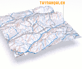 Places with similar names to Taynah Qal‘eh, Afghanistan ::
Disclaimer :: Information on this page comes without warranty of any kind |
||
|
Where is Taynah Qal‘eh? Elevation and coordinates ::
Latitude (lat): 34°16'0"N Longitude (lon): 67°51'0"E
Elevation (approx.): 3059m (map arrows pan, magnifying glasses zoom) |
||
|
Visiting Taynah Qal‘eh? Hotel/Accommodation ::
Book a hotel in Taynah Qal‘eh Travel Guide ::
Buy a travel guide for Afghanistan rental cars ::
car rental offers GPS waypoint ::
download a GPX waypoint (PoI) of Taynah Qal‘eh for your GPS receiver
|
||