|
search place name
|
||
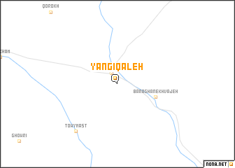
Yangī Qal‘eh (Fāryāb, Afghanistan)Yangī Qal‘eh is a town in the Fāryāb region of Afghanistan. An overview map of the region around Yangī Qal‘eh is displayed below.
regional and 3d topo map of Yangī Qal‘eh, Afghanistan ::
Yangī Qal‘eh airports ::
The nearest airport is MMZ - Maimama Maimana, located 50.3 km north east of Yangī Qal‘eh.
Nearby towns ::
Qeyşār (1.9km north west) //
Baraghan-e Khvājeh (5.4km south east) //
Towy Mast (9.3km south west) //
[all distances 'as the bird flies' and approximate]  Places with similar names to Yangī Qal‘eh, Afghanistan ::
// Yangikly (UZ)
// Yŏnja-gol (KP)
// Yengeh Qal‘eh (IR)
// Yengeh Qal‘eh (IR)
// Yengeh Qal‘eh (IR)
// Yengī Qal‘eh (IR)
// Yengī Qal‘eh (IR)
// Yengī Qal‘eh (IR)
// Yengī Qal‘eh (IR)
// Yangī Qal‘eh (IR)
Disclaimer :: Information on this page comes without warranty of any kind |
||
|
Where is Yangī Qal‘eh? Elevation and coordinates ::
Latitude (lat): 35°40'25"N Longitude (lon): 64°18'11"E
Elevation (approx.): 1302m (map arrows pan, magnifying glasses zoom) |
||
|
Visiting Yangī Qal‘eh? Hotel/Accommodation ::
Book a hotel in Yangī Qal‘eh Travel Guide ::
Buy a travel guide for Afghanistan rental cars ::
car rental offers GPS waypoint ::
download a GPX waypoint (PoI) of Yangī Qal‘eh for your GPS receiver
|
||