|
search place name
|
||
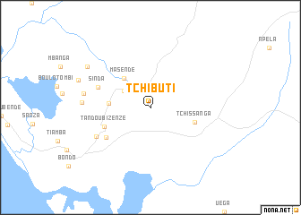
Tchibuti (Cabinda, Angola)Tchibuti is a town in the Cabinda region of Angola. An overview map of the region around Tchibuti is displayed below.
regional and 3d topo map of Tchibuti, Angola ::
Tchibuti airports ::
The nearest airport is PNR - Pointe-noire Pointe Noire, located 30.3 km north west of Tchibuti.
Other airports nearby include CAB - Cabinda (73.6 km south), MNB - Muanda (112.9 km south), SZA - Soyo (136.1 km south), Nearby towns ::
Kitanzi (3.9km north west) //
Masendé (4.8km north west) //
Tandou Mboma (5.2km west) //
Tchissanga (5.8km east) //
Tandou Bizenzé (6.2km south west) //
Chicamba (6.7km south west) //
Massabi (6.7km south west) //
Sinda (7.0km west) //
Bikondolo (7.6km south west) //
Cayo (8.4km west) //
Kifouma (8.5km west) //
Koulombo (9.4km north west) //
[all distances 'as the bird flies' and approximate]  Places with similar names to Tchibuti, Angola ::
Disclaimer :: Information on this page comes without warranty of any kind |
||
|
Where is Tchibuti? Elevation and coordinates ::
Latitude (lat): 4°56'0"S Longitude (lon): 12°8'0"E
Elevation (approx.): 69m (map arrows pan, magnifying glasses zoom) |
||
|
Visiting Tchibuti? Hotel/Accommodation ::
Book a hotel in Tchibuti Travel Guide ::
Buy a travel guide for Angola rental cars ::
car rental offers GPS waypoint ::
download a GPX waypoint (PoI) of Tchibuti for your GPS receiver
|
||