|
search place name
|
||
Alatala (Ijevan, Armenia)Alatala is a town in the Ijevan region of Armenia. An overview map of the region around Alatala is displayed below.
regional and 3d topo map of Alatala, Armenia ::

Nearby towns ::
Qaravǝlilǝr (8.3km south) //
Artsvaberd (7.1km north east) //
Qaralar (8.5km south east) //
Norashen (9.9km north east) //
Chʼoratʼan (9.6km north east) //
[all distances 'as the bird flies' and approximate] 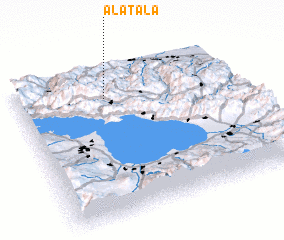 Places with similar names to Alatala, Armenia ::
// Altilia (IT)
// Ahlatlı (TR)
// Alatlı (TR)
// Altaylı (TR)
// Aldeílla (ES)
// Ālideola (BD)
// Āolātail (BD)
// Allah Dal (PK)
// Aladie Ile (NG)
// Awlād ‘Alī (LY)
Disclaimer :: Information on this page comes without warranty of any kind |
||
|
Where is Alatala? Elevation and coordinates ::
Latitude (lat): 40°48'0"N Longitude (lon): 45°24'0"E
Elevation (approx.): 1222m (map arrows pan, magnifying glasses zoom) |
||
|
Visiting Alatala? Hotel/Accommodation ::
Book a hotel in Alatala Travel Guide ::
Buy a travel guide for Armenia rental cars ::
car rental offers GPS waypoint ::
download a GPX waypoint (PoI) of Alatala for your GPS receiver
|
||