|
search place name
|
||
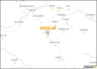
Əngǝlan (Xızı, Azerbaijan)Əngǝlan is a town in the Xızı region of Azerbaijan. An overview map of the region around Əngǝlan is displayed below.
regional and 3d topo map of Əngǝlan, Azerbaijan ::
Əngǝlan airports ::
The nearest airport is BAK - Baku Heydar Aliyev, located 94.2 km south east of Əngǝlan.
Other airports nearby include MCX - Makhachkala Uytash (249.4 km north west), Nearby towns ::
Ashaga Angelan (0.9km south) //
Yukhary Angelan (1.9km north west) //
Qars (4.3km north east) //
Ambizlyar (4.6km south east) //
Yarımca (5.1km north west) //
Karabulak (4.6km east) //
Qızılqazma (6.7km north west) //
Gariban (7.6km north east) //
Shurakend (6.9km north east) //
Khirek (7.1km north east) //
Baxışlı (9.5km north west) //
[all distances 'as the bird flies' and approximate] 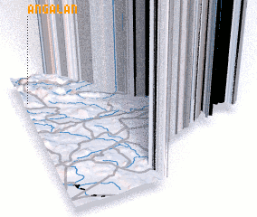 Places with similar names to Əngǝlan, Azerbaijan ::
// Angolon (PH)
// Anquilen (PH)
// Anglin (US)
// An Nakhlayn (LY)
// Angulana (LK)
// Annaclone (GB)
// An Gleann (IE)
// Áno Klinaí (GR)
Disclaimer :: Information on this page comes without warranty of any kind |
||
|
Where is Əngǝlan? Elevation and coordinates ::
Latitude (lat): 40°49'28"N Longitude (lon): 49°2'11"E
Elevation (approx.): 1123m (map arrows pan, magnifying glasses zoom) |
||
|
Visiting Əngǝlan? Hotel/Accommodation ::
Book a hotel in Əngǝlan Travel Guide ::
Buy a travel guide for Azerbaijan rental cars ::
car rental offers GPS waypoint ::
download a GPX waypoint (PoI) of Əngǝlan for your GPS receiver
|
||