|
search place name
|
||
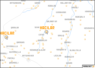
Hacılar (Tovuz, Azerbaijan)Hacılar is a town in the Tovuz region of Azerbaijan. An overview map of the region around Hacılar is displayed below.
regional and 3d topo map of Hacılar, Azerbaijan ::
Nearby towns ::
Saladynly (1.3km east) //
Pǝlǝkli (1.7km north) //
Baqqallı (1.4km east) //
Cirdǝk (1.9km south east) //
Çatax (2.1km south west) //
Mollalar (2.3km south west) //
Kazımlı (2.3km south west) //
Şıxheybǝt (2.7km north west) //
Qandalar (4.0km south) //
Qalaboyun (4.0km north) //
Çeşmǝli (4.4km south) //
Böyükqışlaq (4.3km south west) //
Nǝsibli (4.7km south west) //
Ortaqışlaq (4.7km south west) //
Şamlıq (4.6km south east) //
Abbasqulular (5.7km south) //
Mesmalar (5.6km south west) //
Dǝllǝkli (5.6km south east) //
Sǝfǝrli (5.8km south west) //
Güvǝndik (7.2km south) //
Ağdǝrǝ (5.6km east) //
Kirǝn (7.3km north) //
Osgyan (6.1km south east) //
Böyük Şamlıq (7.0km south east) //
Hǝsǝnli (7.6km south) //
Hǝtǝmlǝr (6.3km east) //
Mǝşǝdivǝlilǝr (7.9km south) //
Meshadikulular (7.9km south) //
Mǝşǝdiqulular (7.9km south) //
[all distances 'as the bird flies' and approximate]  Places with similar names to Hacılar, Azerbaijan ::
Disclaimer :: Information on this page comes without warranty of any kind |
||
|
Where is Hacılar? Elevation and coordinates ::
Latitude (lat): 40°44'0"N Longitude (lon): 45°35'0"E
Elevation (approx.): 1416m (map arrows pan, magnifying glasses zoom) |
||
|
Visiting Hacılar? Hotel/Accommodation ::
Book a hotel in Hacılar Travel Guide ::
Buy a travel guide for Azerbaijan rental cars ::
car rental offers GPS waypoint ::
download a GPX waypoint (PoI) of Hacılar for your GPS receiver
|
||