|
search place name
|
||
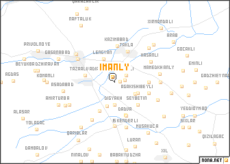
Imanly (Cǝlilabad, Azerbaijan)Imanly is a town in the Cǝlilabad region of Azerbaijan. An overview map of the region around Imanly is displayed below.
regional and 3d topo map of Imanly, Azerbaijan ::
Imanly airports ::
The nearest airport is BAK - Baku Heydar Aliyev, located 194.8 km north east of Imanly.
Other airports nearby include RAS - Rasht (212.3 km south east), Nearby towns ::
Kelʼbaguseynli (0.7km east) //
Çaxırlı (1.3km east) //
Əhmǝdli (1.8km north east) //
Digyakh (3.7km south) //
Sǝrǝfǝ (3.3km south east) //
Agakishibeyli (3.4km south east) //
Lengyan (4.0km north) //
Këgna Alvady (4.1km south) //
Tǝzǝ Alvadıǝ (3.9km west) //
Seybetin (4.7km south east) //
Tǝklǝ (5.2km north) //
Banbaşı (5.2km south) //
Bala Teklya (4.3km east) //
Masallı (5.6km south) //
Kazımabad (5.8km north) //
Samedkhanly Pervyye (4.7km south east) //
Dadva (5.7km south) //
Hǝsǝnli (5.6km north east) //
Göytǝpǝ (6.0km north west) //
Yeyǝnkǝnd (6.8km south west) //
Ərkivan (7.2km south) //
Mamedkhanly (5.8km east) //
Kyurdabazly (5.8km east) //
Etchelyar (6.2km south east) //
Iskenderli (7.6km south) //
Svetlaya Zarya (6.6km north west) //
Mollagasanli (7.0km north east) //
Gadzhytepe (7.0km north east) //
Tatʼyanoba (6.8km south west) //
[all distances 'as the bird flies' and approximate]  Places with similar names to Imanly, Azerbaijan ::
// Immanuel (US)
// I-min-liao (TW)
Disclaimer :: Information on this page comes without warranty of any kind |
||
|
Where is Imanly? Elevation and coordinates ::
Latitude (lat): 39°5'0"N Longitude (lon): 48°39'0"E
Elevation (approx.): -7m (map arrows pan, magnifying glasses zoom) |
||
|
Visiting Imanly? Hotel/Accommodation ::
Book a hotel in Imanly Travel Guide ::
Buy a travel guide for Azerbaijan rental cars ::
car rental offers GPS waypoint ::
download a GPX waypoint (PoI) of Imanly for your GPS receiver
|
||