|
search place name
|
||
Kalatalıq (Kǝlbǝcǝr, Azerbaijan)Kalatalıq is a town in the Kǝlbǝcǝr region of Azerbaijan. An overview map of the region around Kalatalıq is displayed below.
regional and 3d topo map of Kalatalıq, Azerbaijan ::

Kalatalıq airports ::
The nearest airport is TBZ - Tabriz Intl, located 201.0 km south of Kalatalıq.
Nearby towns ::
Tirkǝşǝvǝnd (3.4km north west) //
Qaraxançallı (3.7km north west) //
Alırzalar (4.6km north west) //
Shakhkerem (4.4km west) //
Kazykhanly (4.7km north east) //
Koturlu (5.2km north east) //
Xallanlı (5.9km north west) //
Qovuşuq (7.4km south) //
Çovdar (6.3km west) //
Çobankǝrǝhmǝz (8.5km north) //
Ağçakǝnd (9.5km north west) //
Oğuldǝrǝ (8.9km south east) //
[all distances 'as the bird flies' and approximate] 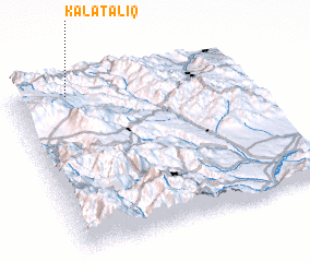 Places with similar names to Kalatalıq, Azerbaijan ::
// Cloud Lake (US)
// Qal‘at ‘Ullayqah (SY)
// Cold Lake (CA)
// Kildalloig (GB)
// Kildalkey (IE)
// Çöl Dǝllǝk (AZ)
Disclaimer :: Information on this page comes without warranty of any kind |
||
|
Where is Kalatalıq? Elevation and coordinates ::
Latitude (lat): 39°56'40"N Longitude (lon): 46°14'13"E
Elevation (approx.): 1928m (map arrows pan, magnifying glasses zoom) |
||
|
Visiting Kalatalıq? Hotel/Accommodation ::
Book a hotel in Kalatalıq Travel Guide ::
Buy a travel guide for Azerbaijan rental cars ::
car rental offers GPS waypoint ::
download a GPX waypoint (PoI) of Kalatalıq for your GPS receiver
|
||