|
search place name
|
||
Mastail (Lerik, Azerbaijan)Mastail is a town in the Lerik region of Azerbaijan. An overview map of the region around Mastail is displayed below.
regional and 3d topo map of Mastail, Azerbaijan ::

Mastail airports ::
The nearest airport is RAS - Rasht, located 194.4 km south east of Mastail.
Other airports nearby include BAK - Baku Heydar Aliyev (234.3 km north east), Nearby towns ::
Livǝdirgǝ (3.0km north) //
Hıramo (2.4km east) //
Yuxarı Bilnǝ (2.6km north east) //
Lerik (2.7km south east) //
Əvilǝ (3.3km north) //
Şinǝbǝnd (3.8km south west) //
Nüsomurya (3.8km north east) //
Qadimkücǝ (3.8km north east) //
Vǝlǝçola (3.5km east) //
Nuravad (3.8km south west) //
Durqan (4.9km north) //
Zǝrdǝbǝrǝ (4.3km south west) //
Murya (5.2km north) //
Cǝngǝmiran (5.4km south east) //
Molalan (6.5km north) //
Orand (6.0km south west) //
Aşağı Bilnǝ (5.3km east) //
Āqā Yārlū (6.6km south) //
Yūzbāshī Maḩallehsī (6.6km south) //
Bizeyir (6.8km south) //
Lülǝkǝran (6.7km south) //
Bilabǝnd (6.7km south east) //
Pirǝsora (7.7km south) //
Soru (7.8km north) //
Xǝlfǝkücǝ (7.3km south east) //
Şingǝdulan (7.9km north) //
Shivlya (6.9km north west) //
Laman (7.7km north east) //
Kekonu (6.4km west) //
[all distances 'as the bird flies' and approximate] 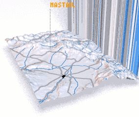 Places with similar names to Mastail, Azerbaijan ::
Disclaimer :: Information on this page comes without warranty of any kind |
||
|
Where is Mastail? Elevation and coordinates ::
Latitude (lat): 38°47'23"N Longitude (lon): 48°23'25"E
Elevation (approx.): 918m (map arrows pan, magnifying glasses zoom) |
||
|
Visiting Mastail? Hotel/Accommodation ::
Book a hotel in Mastail Travel Guide ::
Buy a travel guide for Azerbaijan rental cars ::
car rental offers GPS waypoint ::
download a GPX waypoint (PoI) of Mastail for your GPS receiver
|
||