|
search place name
|
||
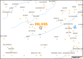
Pǝlikǝş (Astara, Azerbaijan)Pǝlikǝş is a town in the Astara region of Azerbaijan. An overview map of the region around Pǝlikǝş is displayed below.
regional and 3d topo map of Pǝlikǝş, Azerbaijan ::
Pǝlikǝş airports ::
The nearest airport is RAS - Rasht, located 157.0 km south east of Pǝlikǝş.
Other airports nearby include BAK - Baku Heydar Aliyev (246.9 km north east), Nearby towns ::
Şümrüd (1.4km north) //
Dürriyǝ (1.6km north east) //
Vovlada (1.6km south east) //
Asxanakǝran (2.6km west) //
Sım (3.5km south) //
Dolu (3.5km west) //
Avyarud (3.6km south west) //
Balbau (5.3km north) //
Sipiyǝt (4.3km west) //
Rıqloba (5.6km north west) //
Diqo (6.4km south west) //
Hamoşam (6.6km north west) //
Ovala (6.6km north east) //
Bursut (7.5km north west) //
Dylʼmady (8.1km south) //
Shua (6.9km south east) //
Motolayataq (8.6km north) //
Şıxımpeştǝ (8.6km north) //
Azaru (7.7km north west) //
Xıçaso (7.5km north east) //
Qǝğoy (11.0km north west) //
[all distances 'as the bird flies' and approximate] 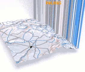 Places with similar names to Pǝlikǝş, Azerbaijan ::
Disclaimer :: Information on this page comes without warranty of any kind |
||
|
Where is Pǝlikǝş? Elevation and coordinates ::
Latitude (lat): 38°31'21"N Longitude (lon): 48°39'16"E
Elevation (approx.): 704m (map arrows pan, magnifying glasses zoom) |
||
|
Visiting Pǝlikǝş? Hotel/Accommodation ::
Book a hotel in Pǝlikǝş Travel Guide ::
Buy a travel guide for Azerbaijan rental cars ::
car rental offers GPS waypoint ::
download a GPX waypoint (PoI) of Pǝlikǝş for your GPS receiver
|
||