|
search place name
|
||
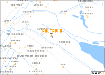
Poltavka (İmişli, Azerbaijan)Poltavka is a town in the İmişli region of Azerbaijan. An overview map of the region around Poltavka is displayed below.
regional and 3d topo map of Poltavka, Azerbaijan ::
Poltavka airports ::
The nearest airport is BAK - Baku Heydar Aliyev, located 186.2 km north east of Poltavka.
Other airports nearby include TBZ - Tabriz Intl (237.8 km south west), Nearby towns ::
Qızılkǝnd (2.9km north west) //
Semënovka (3.4km north west) //
Suvorovka (4.2km south east) //
Yeddioymaq (4.9km south) //
Ḩājjī Ja‘far Kandī (7.3km south west) //
Bahrāmābād (8.2km south west) //
Ūrtlū (7.2km south west) //
Qulubǝyli (9.1km north) //
Ḩamdollāhābād (8.8km south west) //
Mǝzrǝli (9.8km north west) //
Khub”yarly (10.7km north west) //
[all distances 'as the bird flies' and approximate]  Places with similar names to Poltavka, Azerbaijan ::
Disclaimer :: Information on this page comes without warranty of any kind |
||
|
Where is Poltavka? Elevation and coordinates ::
Latitude (lat): 39°42'4"N Longitude (lon): 48°6'15"E
Elevation (approx.): 6m (map arrows pan, magnifying glasses zoom) |
||
|
Visiting Poltavka? Hotel/Accommodation ::
Book a hotel in Poltavka Travel Guide ::
Buy a travel guide for Azerbaijan rental cars ::
car rental offers GPS waypoint ::
download a GPX waypoint (PoI) of Poltavka for your GPS receiver
|
||