|
search place name
|
||
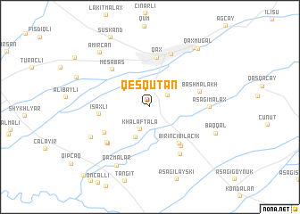
Qeşqutan (Qax, Azerbaijan)Qeşqutan is a town in the Qax region of Azerbaijan. An overview map of the region around Qeşqutan is displayed below.
regional and 3d topo map of Qeşqutan, Azerbaijan ::
Qeşqutan airports ::
The nearest airport is MCX - Makhachkala Uytash, located 172.2 km north of Qeşqutan.
Nearby towns ::
Əmbǝrçay (2.2km north east) //
Khalaftala (2.9km south) //
Qımırlı (4.0km south) //
Birinci Bilǝcik (5.2km south east) //
İkinci Bilǝcik (5.6km south east) //
Qax (6.2km north) //
Bashmalakh (5.0km north east) //
İsaxlı (4.9km west) //
İngiloy Kötüklü (5.4km south west) //
Meşǝbaş (5.9km north west) //
Abaskǝnd (6.4km south east) //
Qaratala (6.0km south west) //
Əli Bayramlı (6.0km south west) //
Qax İngiloy (6.9km north) //
AşağıMalax (5.6km east) //
Uzuntala (6.7km south west) //
Qazmalar (7.9km south west) //
Baqqal (7.0km south east) //
Qaxbaş (8.5km north east) //
Əmircan (8.4km north west) //
Qaxmuğal (8.6km north east) //
Suskǝnd (9.5km north west) //
Qaysarlı (10.6km south west) //
[all distances 'as the bird flies' and approximate] 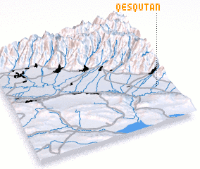 Places with similar names to Qeşqutan, Azerbaijan ::
// Kiçik Dǝhnǝ (AZ)
// Quasqueton (US)
// Casa Gaetani (IT)
// Kızkadın (TR)
// Kuzugüden (TR)
// Kaskadnyy (RU)
// Cascaden (PE)
// Kūz Katan (PK)
// Kūz Katan (PK)
// Coşcodeni (MD)
Disclaimer :: Information on this page comes without warranty of any kind |
||
|
Where is Qeşqutan? Elevation and coordinates ::
Latitude (lat): 41°22'0"N Longitude (lon): 46°55'0"E
Elevation (approx.): 400m (map arrows pan, magnifying glasses zoom) |
||
|
Visiting Qeşqutan? Hotel/Accommodation ::
Book a hotel in Qeşqutan Travel Guide ::
Buy a travel guide for Azerbaijan rental cars ::
car rental offers GPS waypoint ::
download a GPX waypoint (PoI) of Qeşqutan for your GPS receiver
|
||