|
search place name
|
||
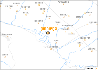
Qındırqa (Qax, Azerbaijan)Qındırqa is a town in the Qax region of Azerbaijan. An overview map of the region around Qındırqa is displayed below.
regional and 3d topo map of Qındırqa, Azerbaijan ::
Qındırqa airports ::
The nearest airport is MCX - Makhachkala Uytash, located 180.2 km north east of Qındırqa.
Nearby towns ::
Lǝlǝli (3.6km south east) //
Zǝyǝm (4.7km north east) //
Tsit'eli Sabat'lo (5.4km south) //
Kürdǝmir (5.4km north west) //
Lahıc (6.2km north) //
Şotavar (4.9km east) //
Qarabaldır (6.1km north east) //
Verxijan (8.5km north) //
Tasmalı (8.2km north east) //
Lǝlǝpaşa (9.1km north east) //
Mosul (10.1km north west) //
[all distances 'as the bird flies' and approximate]  Places with similar names to Qındırqa, Azerbaijan ::
// Candarog (PH)
// Cantaroc A (PH)
// Kendrick (US)
// Kendrick (US)
// Kānī Dārkah (IQ)
// Kendrić (BA)
// Kontorka (RU)
// Kontorka (RU)
// Kontorka (RU)
// Kendrick (US)
Disclaimer :: Information on this page comes without warranty of any kind |
||
|
Where is Qındırqa? Elevation and coordinates ::
Latitude (lat): 41°22'32"N Longitude (lon): 46°39'6"E
Elevation (approx.): 172m (map arrows pan, magnifying glasses zoom) |
||
|
Visiting Qındırqa? Hotel/Accommodation ::
Book a hotel in Qındırqa Travel Guide ::
Buy a travel guide for Azerbaijan rental cars ::
car rental offers GPS waypoint ::
download a GPX waypoint (PoI) of Qındırqa for your GPS receiver
|
||