|
search place name
|
||
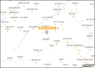
Sumağava (Dǝvǝçi, Azerbaijan)Sumağava is a town in the Dǝvǝçi region of Azerbaijan. An overview map of the region around Sumağava is displayed below.
regional and 3d topo map of Sumağava, Azerbaijan ::
Sumağava airports ::
The nearest airport is BAK - Baku Heydar Aliyev, located 131.7 km south east of Sumağava.
Other airports nearby include MCX - Makhachkala Uytash (204.0 km north west), Nearby towns ::
Sumağavaqazma (1.2km south) //
Pirǝbǝdil (1.8km north west) //
Zöhramlı (2.3km north) //
Qorqan (3.1km south) //
Dağ Bilici (2.6km north east) //
Löyti (4.6km north east) //
(( Izmara )) (4.5km south east) //
Düz Bilici (5.1km south east) //
(( Leyti-Kazma )) (5.7km north) //
Zağlı (5.6km south) //
(( Sofukend )) (4.7km north west) //
Qalagah (4.8km east) //
Lǝcǝdi (5.6km north east) //
Xǝlfǝlǝr (6.4km south east) //
Çinarlar (7.9km south) //
Zeyva (6.5km west) //
Yelǝkǝsǝn (6.9km south east) //
Pirǝmsǝn (8.4km north east) //
Ərǝblǝr (9.3km north) //
İdrisqışlaq (9.9km north west) //
[all distances 'as the bird flies' and approximate]  Places with similar names to Sumağava, Azerbaijan ::
// Samokov (BG)
// Sumkova (LV)
// Samakova (UA)
// Smykov (UA)
// Sambaokofa (MG)
// Sambaokofa (MG)
// Semokfu (CD)
// Samokov (MK)
// Samakūfah (SY)
// Xóm Cư Phú (VN)
Disclaimer :: Information on this page comes without warranty of any kind |
||
|
Where is Sumağava? Elevation and coordinates ::
Latitude (lat): 41°11'57"N Longitude (lon): 48°49'3"E
Elevation (approx.): 509m (map arrows pan, magnifying glasses zoom) |
||
|
Visiting Sumağava? Hotel/Accommodation ::
Book a hotel in Sumağava Travel Guide ::
Buy a travel guide for Azerbaijan rental cars ::
car rental offers GPS waypoint ::
download a GPX waypoint (PoI) of Sumağava for your GPS receiver
|
||