|
search place name
|
||
High Sand (Stann Creek, Belize)High Sand is a town in the Stann Creek region of Belize. An overview map of the region around High Sand is displayed below.
regional and 3d topo map of High Sand, Belize ::

High Sand airports ::
The nearest airport is BZE - Belize City Philip S W Goldson Intl, located 80.0 km north of High Sand.
Other airports nearby include TEA - Tela (145.0 km south east), SAP - San Pedro Sula La Mesa Intl (156.2 km south), CTM - Chetumal Intl (186.8 km north), LCE - La Ceiba Goloson Intl (195.1 km south east), Nearby towns ::
Middle Bank (1.9km north) //
Freetown Area (1.8km east) //
Sittee (2.6km north east) //
Regalia (2.6km south west) //
Commerce Bight Village (5.6km north) //
Hopkins (5.8km north) //
Kendal (7.3km west) //
Silk Grass (8.2km north west) //
[all distances 'as the bird flies' and approximate] 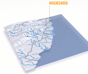 Places with similar names to High Sand, Belize ::
// Havøysund (NO)
Disclaimer :: Information on this page comes without warranty of any kind |
||
|
Where is High Sand? Elevation and coordinates ::
Latitude (lat): 16°49'0"N Longitude (lon): 88°18'0"W
Elevation (approx.): 5m (map arrows pan, magnifying glasses zoom) |
||
|
Visiting High Sand? Hotel/Accommodation ::
Book a hotel in High Sand Travel Guide ::
Buy a travel guide for Belize rental cars ::
car rental offers GPS waypoint ::
download a GPX waypoint (PoI) of High Sand for your GPS receiver
|
||