|
search place name
|
||
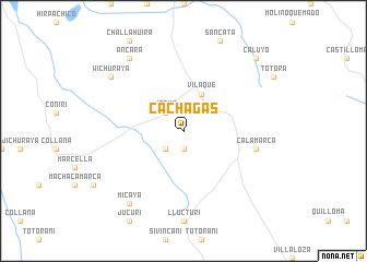
Cachagas (La Paz, Bolivia)Cachagas is a town in the La Paz region of Bolivia. An overview map of the region around Cachagas is displayed below.
regional and 3d topo map of Cachagas, Bolivia ::
Cachagas airports ::
The nearest airport is LPB - La Paz El Alto Intl, located 41.0 km north of Cachagas.
Other airports nearby include CBB - Cochabamba Jorge Wilsterman (219.9 km east), JUL - Juliaca (264.4 km north west), Nearby towns ::
Pinaya (1.9km south) //
Cunucunu (2.6km north west) //
Jaque (2.6km north west) //
Cusmini (2.6km south west) //
Vilaque (4.1km north east) //
Calamarca (7.3km east) //
Wichuraya (9.0km north west) //
Ancara (9.1km north west) //
Micaya (9.1km south west) //
Caluyo (10.3km north east) //
[all distances 'as the bird flies' and approximate]  Places with similar names to Cachagas, Bolivia ::
// Kuchuk Ass (UA)
// Kachikasy (RU)
// Kuchkas (RU)
// Guichixú (MX)
// Kashkasu (KG)
// Kashkasu (KG)
// Kūcheh Gazī (IR)
// Kūchek Zā'ī (IR)
// Caychax (FR)
// Cuchicasi (BO)
Disclaimer :: Information on this page comes without warranty of any kind |
||
|
Where is Cachagas? Elevation and coordinates ::
Latitude (lat): 16°53'0"S Longitude (lon): 68°10'0"W
Elevation (approx.): 3982m (map arrows pan, magnifying glasses zoom) |
||
|
Visiting Cachagas? Hotel/Accommodation ::
Book a hotel in Cachagas Travel Guide ::
Buy a travel guide for Bolivia rental cars ::
car rental offers GPS waypoint ::
download a GPX waypoint (PoI) of Cachagas for your GPS receiver
|
||